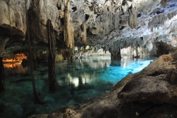
Xcaret Park is a privately operated attraction on Mexico’s Caribbean coast, near Playa del Carmen in Quintana Roo. The company says the park opened in December 1990 after five years of development. Today its offer combines water activities, wildlife exhibits, landscaped paths, food and performances. That mix matters when planning: Xcaret is not a small archaeological stop but a large, ticketed day out, and visitors usually need to choose priorities rather than expect to see everything at an unhurried pace.
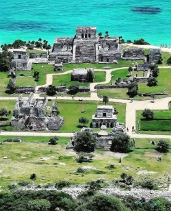
The name also points to a history older than the leisure complex. Mexico’s National Institute of Anthropology and History, INAH, says the pre-Hispanic and colonial settlement was called P’olé; the modern name’s origin and meaning are unknown. P’olé was an important trading port and a departure and arrival point for pilgrimages to Cozumel. These historical remains and the modern commercial park occupy a shared landscape, but they are not the same attraction or the same visitor service.