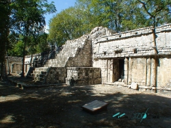
South of Mérida, beyond the best-known Maya routes, Chacmultún occupies a valley near Tekax in Yucatán. Its name is commonly rendered by Mexico’s National Institute of Anthropology and History as “red stone hill” or “red-stone mounds,” a reference to the warm pink-red tones of the building stone. The colour is not a modern paint effect: the INAH explains that the stone’s appearance changes as its surface interacts with air and water.
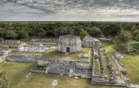
The site belongs to the Puuc region, a cultural landscape recognized for carefully cut masonry, elaborate façades and patterned stone mosaics. At Chacmultún, the surviving buildings rise above a wooded valley, and their red-toned surfaces can appear especially vivid in strong light. The setting is part of the visit: this is not a monumental plaza detached from its environment, but a settlement whose architecture sits within a landscape of hills, seasonal water and vegetation.