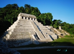
Yaxchilán stands on the Mexican bank of the Usumacinta River in Chiapas, within the Lacandon rainforest. Unlike archaeological zones reached directly by road, the site’s usual visitor route ends at Frontera Corozal, where a boat carries passengers upstream to the ruins. The journey is part of the experience: buildings emerge from a green river landscape, and the river that shaped the ancient city still defines how visitors arrive.
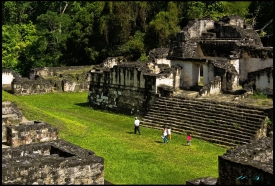
The city’s layout responds closely to its setting. The Great Plaza follows a natural riverside terrace, while the Great and West Acropolises rise on limestone hills to the south. This arrangement brings plazas, temples and elevated residential or ceremonial groups into one connected urban landscape. The site’s scale becomes clearer on foot, where stairs and paths link buildings above the river level, rather than from a single distant viewpoint.