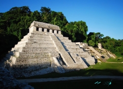
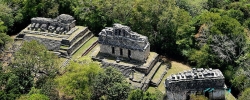
About 10 kilometres east of Ocosingo in Chiapas, Toniná rises from the valley as a monumental Maya city and archaeological landscape. The name Toniná comes from Tzeltal; the National Institute of Anthropology and History (INAH) gives interpretations including “stone house” and “place where sculptures are raised in stone in honour of time.” The location sits near the transition between highland and lowland environments, a setting that helps explain the city’s commanding position in the western Maya area.
The best-known feature is the acropolis, a large built complex whose central stairway crosses seven platforms. INAH describes 260 steps, 13 temples at the summit and a pyramid structure more than 70 metres high. Rather than a solitary pyramid standing on a flat plain, Toniná is a sequence of terraces, palaces, temples and open spaces built into the slope. The scale becomes clearer when visitors take in the whole face of the acropolis before focusing on individual structures.