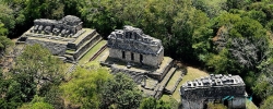
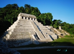
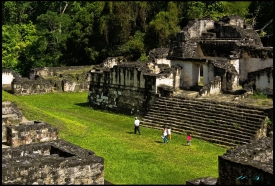
Bonampak is a Maya archaeological site in the municipality of Ocosingo, Chiapas, surrounded by the Lacandon Forest. Its political and ceremonial centre was not among the largest Maya cities, yet the settlement spread across a productive valley where people cultivated staple foods and cacao. INAH describes a dispersed urban layout with a central plaza, religious and residential buildings, carved stelae and a stepped Acropolis rising about 46 metres above the surrounding terrain.
The city flourished especially between about AD 600 and 800, during the Late Classic period. INAH says its early history was associated first with the influence of Piedras Negras and later Yaxchilán. The surviving monuments show that political authority was negotiated through alliances, succession and display. Bonampak’s scale can be misleading: its fame comes less from a vast field of monumental pyramids than from an unusually informative group of carved and painted buildings.