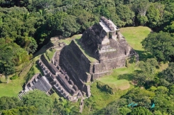
Deep in the lush lowlands of Guatemala’s Petén Basin lies Tikal, one of the greatest urban centers of the pre-Columbian Maya world. Surrounded by dense tropical rainforest, the city rose to prominence around 400 BCE and flourished for nearly 1,300 years. Its strategic position allowed Tikal to dominate trade routes and political alliances across Mesoamerica, linking it to distant civilizations such as Teotihuacan in central Mexico.
By the Classic Period (200–900 CE), Tikal was a thriving metropolis of temples, plazas, and palaces, home to tens of thousands of inhabitants. Archaeologists have mapped more than 3,000 structures spread over 16 square kilometers (6.2 sq mi), revealing a city of astonishing architectural sophistication and urban planning.