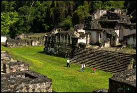
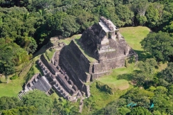
Cerro Cahuí Protected Biotope safeguards a compact but biologically important section of tropical forest on the northeastern shore of Lake Petén Itzá. The reserve’s name is explained by CONAP as “giant lizard or crocodile,” inspired by the ridge’s silhouette when seen from the opposite shore. Trails rise from near El Remate to viewpoints over the lake and the forest canopy.
Created in 1989, the biotope covers 734.77 hectares and is administered by CECON, the conservation centre of the University of San Carlos. It forms part of the core zone of the Maya Biosphere Reserve. Its original conservation emphasis includes the ocellated turkey, while the forest also supports monkeys, birds, reptiles and many plants. Wildlife is free-ranging, so sightings cannot be guaranteed.