About Archaeological Site of Yaxchilán
A Maya city approached from the river
Yaxchilán stands on the Mexican bank of the Usumacinta River in Chiapas, within the Lacandon rainforest. Unlike archaeological zones reached directly by road, the site’s usual visitor route ends at Frontera Corozal, where a boat carries passengers upstream to the ruins. The journey is part of the experience: buildings emerge from a green river landscape, and the river that shaped the ancient city still defines how visitors arrive.
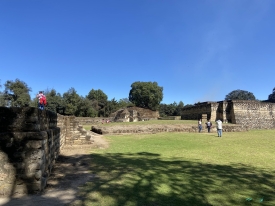
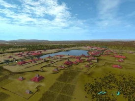
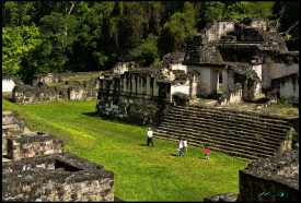
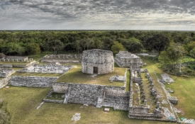
The city’s layout responds closely to its setting. The Great Plaza follows a natural riverside terrace, while the Great and West Acropolises rise on limestone hills to the south. This arrangement brings plazas, temples and elevated residential or ceremonial groups into one connected urban landscape. The site’s scale becomes clearer on foot, where stairs and paths link buildings above the river level, rather than from a single distant viewpoint.
The name Yaxchilán was given to the ruins by explorer Teobert Maler, who took it from a nearby stream. Earlier visitors used other names, including Mench and Lorillard. INAH’s historical account notes that the site became more widely known after Alfred Maudslay and Désiré Charnay reached it in 1882. The name’s history is a reminder that the modern label reflects exploration as well as Maya history; it should not be treated as a direct translation of the city’s ancient name.
Monuments that tell a dynastic story
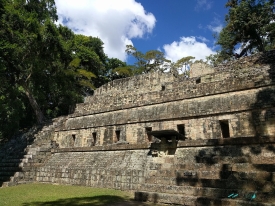
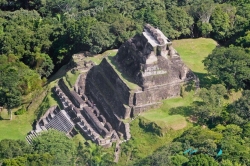
Yaxchilán is especially known for carved stone monuments. INAH counts 124 inscriptions distributed across 30 stelae, 21 altars, 59 lintels and several other inscribed pieces; the site has more than 130 monuments overall. The texts record political alliances and conflict, ceremonies and rulers. Rather than functioning as a neutral chronicle, they were created in particular moments of power and could present a dynastic version of the past. Several rulers dominate the surviving record, including Shield Jaguar I, Bird Jaguar IV and Shield Jaguar II. Monuments associated with Bird Jaguar IV are particularly prominent in the Great Acropolis. Building 33, with its monumental roof comb, is one of the city’s best-known structures; nearby lintels and steps refer to the ruler and to ceremonies. In the West Acropolis, Building 44 and its inscribed stairway connect architecture with accounts of military victories and royal authority.
The inscriptions also reveal why historians read the record critically. INAH notes that monuments recounting the first ten rulers were erected during Bird Jaguar IV’s reign, raising the possibility that this sequence was an official or constructed history intended to legitimize his authority. The earliest historical date cited at the site appears on Stela 27 and refers to 514 CE, yet the monument’s later context matters. The city’s surviving texts are invaluable evidence, but they are political statements that need interpretation.
Yaxchilán’s urban life reached a major phase during the Late Classic, broadly dated by INAH to 600–800 CE, while the dynastic record reaches back to earlier centuries. Monument building paused for a long interval in the sixth and seventh centuries before resuming. The city was eventually abandoned around 900. These broad periods help situate the remains, but individual buildings and inscriptions have their own histories; a single date should not be applied to the entire complex.
What to see and how to prepare for the boat trip
INAH’s current visitor listing gives daily hours of 8:00 a.m. to 4:30 p.m., with last entry at 4:00 p.m., and lists admission to the archaeological zone as free. A separate INAH zone page displays different hours, so confirm the schedule with the site or INAH Chiapas before travelling. The river transfer is a separate expense arranged at Frontera Corozal; fares and operating conditions are not the same as archaeological admission and should be checked directly with boat operators.
From Palenque, INAH describes a road journey of about 185 kilometres to Frontera Corozal, followed by roughly an hour by boat along the Usumacinta. Other approaches may involve small aircraft, but the river route is the standard visitor experience. Build in time for road conditions, the boat departure and the return journey. Do not assume that arriving close to the posted closing time will leave enough time for the crossing and a meaningful walk around the ruins. The site is remote and has limited visitor services. INAH lists an information module and restrooms, but not food service or access for pets. Bring drinking water, insect protection, a hat and comfortable footwear for steps, uneven ground and uphill paths. The humid forest setting can make a short walk feel demanding, and there is no reason to rush between the river landing, plazas and acropolises. Ask locally about the final boat back before beginning the visit.
Travel logistics are part of responsible planning here. Confirm the boat price, payment method, departure timetable and whether a return seat is secured; posted costs can change and may be charged per boat rather than per passenger. Check weather and river conditions, especially after heavy rain, and carry cash if local operators require it. Contact information published by INAH includes the Chiapas office numbers +52 (961) 612-2824 and related local numbers; verify current details before relying on them.
Experience the architecture without turning history into legend
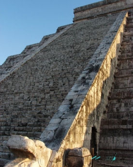
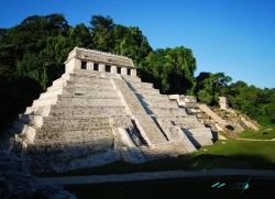
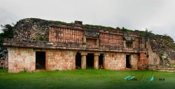
Yaxchilán rewards visitors who read the city as both architecture and landscape. The Great Plaza sits on a terrace shaped by the river, while steps climb toward the Great Acropolis and Building 33. The West Acropolis occupies a natural rise, and the Labyrinth, Building 19, is known for its complex interior passages. These spaces do not merely provide a dramatic backdrop: their elevations, routes and thresholds show how the city organized movement and civic or ritual life.
Carved monuments invite close observation, but their stories should be described carefully. Lintels show rulers and ceremonial scenes; stelae carry dates and inscriptions; some original pieces are now held in museums or protected on site. INAH’s descriptions connect particular structures to named rulers and events, while also acknowledging uncertainty in reconstructed dynastic history. Avoid presenting a political inscription as an impartial record, or suggesting every carved scene has a single agreed interpretation.
Yaxchilán is not a quick roadside stop. It is a boat-and-walking excursion in a forest setting, and the logistics shape what can be seen in a day. Confirm the current INAH hours and the boat arrangements, allow enough time to explore the main plazas and acropolises, and leave space to notice the river and forest around the masonry. The result is a richer visit: a city of Maya political history approached through the same waterway that connected it to its region.