About Tikal
A city shaped by Maya history and forest
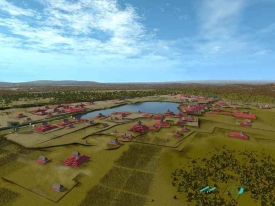
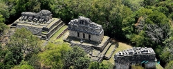
Approaching Tikal through the Petén forest, the first impression can be misleading: the visible temples seem to rise from an empty wilderness. Tikal was a major Maya city whose civic, ceremonial and residential landscape grew within a living tropical environment. Its forest is part of a protected cultural and natural setting.
UNESCO’s record traces a documented dynastic sequence from 292 to 869 CE, spanning 1,161 years and naming 33 rulers. Those dates refer to the inscriptions that preserve the sequence, not to the beginning or end of all human occupation at Tikal. Stelae and carved monuments made political memory visible in public space: they recorded rulers, events and ceremonies in a city where architecture and writing worked together.
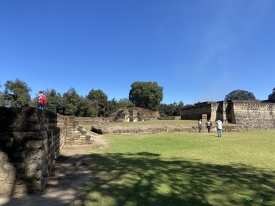
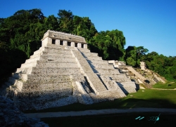
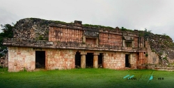
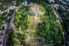
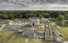
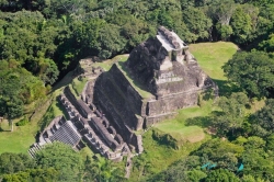
The Great Plaza remains the clearest place to understand that relationship. The monumental temples and adjoining acropolises frame a broad civic space, while smaller courts and building groups extend the urban fabric beyond the postcard view. Guatemala’s Ministry of Culture identifies the Plaza Mayor, the Temples of the Great Jaguar and Masks, the North and Central Acropolises, Mundo Perdido and Temple IV among the park’s principal features.
It is tempting to reduce Tikal to a single dramatic period or a precise population estimate. Inscriptions, architecture, excavated objects and mapped remains instead show a long-lived center that changed over time. Researchers continue to investigate these changes, so not every interpretation is settled.
Monuments, inscriptions and a protected landscape
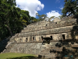
Tikal’s monumental architecture is often described through its plazas, temples, palaces and raised platforms. Their scale matters, but so does their arrangement: open ceremonial ground gives way to enclosed courts, elevated buildings and routes that control what a visitor sees next. These transitions help visitors read the site as a deliberately organized city. They also show why a walk through Tikal rewards patience; the meaning is distributed among many structures, not concentrated in one viewpoint.
The park covers 57,600 hectares, according to UNESCO, and forms part of the wider Maya Forest. That expanse includes archaeological remains as well as savannas, wetlands, freshwater systems and several forest types. UNESCO reports more than 330 recorded bird species and over 100 mammals in the property, including jaguar, puma, ocelot, margay and howler monkey. These are documented ecological values, not a promise that every visitor will see those animals on a particular day.
This dual designation changes how the ruins should be experienced. Tropical weather, vegetation growth and the passage of visitors all affect ancient materials. UNESCO identifies weathering, looting, tourism pressure, waste and physical erosion among management concerns. The practical consequence is simple: stay on authorized routes, respect closed areas and do not climb a building unless signs explicitly allow it. A photograph is not worth damage to masonry or risk to a visitor.
The protected area’s history also has specific milestones. Tikal was declared a national monument in 1931 and a national park in 1955; UNESCO inscribed it on the World Heritage List in 1979. In 1990 it became one of the core areas of the Maya Biosphere Reserve. These labels describe overlapping responsibilities: the national park protects archaeological and ecological resources, while the international designations recognize values that extend beyond Guatemala’s borders.
Planning a visit from Flores
Tikal lies in Guatemala’s department of Petén, about 63 kilometres from Flores, according to the Ministry of Culture’s visitor page. That makes Flores a practical base for many itineraries, but the drive is still a separate leg that should be planned rather than treated as a short walk from town. The ministry describes road access via the CA-13 and the turn toward El Remate; it also notes that collective and private transport services operate daily. Confirm the day’s transport with the operator you intend to use.
The ministry currently lists regular public entry from 6 a.m. to 6 p.m. every day. Special sunrise access is approximately 4–6 a.m., and sunset access approximately 6–8 p.m.; these are separate ticket options, and an authorized guide is required for the special periods. Do not assume that a standard daytime ticket permits an early entry or that a temple viewpoint is open at any hour. Check the official ticket information immediately before travelling, since exceptional closures can occur.
CulturaGuate lists admission at Q150 for foreign visitors and Q25 for Guatemalan nationals, with separate charges for sunrise or sunset, museums and camping. The official ticket portal says tickets can be bought online in advance, while connectivity inside the park may be limited and there is no ticket office within the park itself. Bring the ticket document and identification required for validation. Because prices and procedures can change, verify them on the government portal rather than relying on an old tour listing.
For a first visit, decide whether the priority is the central ceremonial core, a longer forest walk, a guided interpretation or an early/late entry before arranging transport. A guide is not required for the regular daytime circuit, but special sunrise and sunset access does require an authorized guide. Wear shoes suited to uneven paths, carry water and sun protection, and allow time for the journey back to Flores. The best itinerary leaves room to stop and observe rather than racing between named monuments.
What Tikal reveals—and what it asks visitors to protect
Tikal’s appeal lies in the way evidence and atmosphere meet. A carved monument anchors a political record; a plaza gives that record a public setting; the surrounding forest reveals the ecological scale of the protected property. People built, maintained and reshaped an urban center here over many centuries, while the modern park works to safeguard its remains and surrounding habitats.
That protection is an ongoing task, not a completed achievement. UNESCO notes that tourism supports local economic activity and can contribute to education and conservation, while seasonal visitor peaks also create pressure on fragile remains. The balance depends on administration, staffing, community relationships and visitor conduct. Following staff directions, carrying out waste and leaving plants and wildlife undisturbed are small actions with a direct connection to the park’s stated purpose.
A visit also benefits from separating fact from legend. The ancient Maya world was not a single uniform culture, and Tikal was one influential center among many. Its inscriptions and buildings provide unusually rich evidence, yet they do not explain every aspect of daily life or the meanings of every symbol. A good museum visit, a careful guide and the official audio resources can add context without pretending that archaeology has answered everything.
In the end, Tikal is best encountered as more than a collection of famous silhouettes. Walk from the Great Plaza into the surrounding building groups, notice how the forest alternately hides and reveals the city, and remember that this is still a protected landscape with rules and limits. The experience becomes deeper when grandeur is paired with care: the monuments are extraordinary, but so is the long, unfinished work of keeping their setting intact.