Xunantunich Maya Ruins: Ferry, friezes and the ancient city
A river crossing before the ancient city
At Xunantunich, the journey begins at the Mopan River. Near San José Succotz in western Belize, visitors cross by a hand-cranked ferry before reaching the archaeological reserve. The passage is more than an attractive prelude. It makes clear that this was a city in a landscape of river routes, settlements and fields, not an isolated pyramid placed for a photograph. Belize's National Institute of Culture and History places the site in Cayo District and calls it one of the country's oldest archaeological parks. Its modern name is often translated as “Stone Lady” or “Maiden of the Rock.”
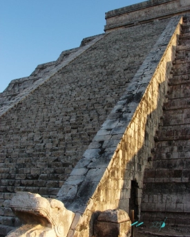
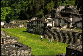
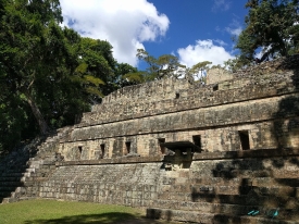
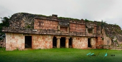
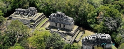
On the far bank, the ground rises toward the central plazas. El Castillo, the largest structure, stands about 130 feet high according to the institute. Its scale can dominate a first impression, but the site is a group of buildings and open spaces rather than one tower. The east and west sides of Structure A-6 retain the remains of a remarkable stucco frieze. These modeled surfaces matter as much as the height: architecture here carried images as well as mass, and the surviving fragments must be read as evidence of a culture, not treated as decoration for a climb.
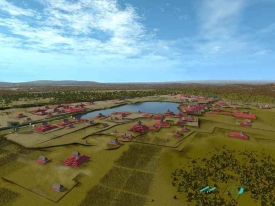
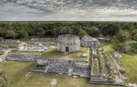
The Belize Tourism Board's guide describes a ceremonial city whose importance grew between roughly 700 and 1000 CE, when many other regional centres were declining. That broad span is not a date for every wall or a claim that the place appeared suddenly. Excavation and survey have traced changing settlement across the Mopan valley. The visible core is only part of that story. From the start, Xunantunich asks visitors to look beyond the most famous silhouette and consider the people and networks that made a major centre possible.
Plazas, friezes and the Maya past
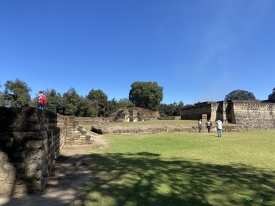
El Castillo is an architectural statement. The tourism board identifies four main groups of buildings in the core and notes the carved friezes on the east and west of its highest structure. A separate national guide describes plazas, a ballcourt and other remains beyond the main pyramid. Following the marked circulation through the reserve gives each element room in the story. The buildings frame open gathering places; the ballcourt recalls a formal practice that was part of Maya public life. None of these spaces can be understood solely by measuring how high the largest temple rises.
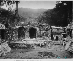
Research at Xunantunich has its own history. Belize's national tour-guide training material records early surveys, mapping and later archaeological projects that examined the city's political development. It describes work in the 1990s on the western side of El Castillo that revealed a monumental plaster frieze, followed by conservation. That older account is useful for understanding how the familiar visitor site was studied and protected. It should not be mistaken for a report that every proposal made decades ago has since been completed.
A name can also shape expectations. “Stone Lady” belongs to the modern identification of Xunantunich; it should not turn an unverified ghost story into a fact about ancient Maya life. Earlier descriptions have repeated a tale about a woman seen near the ruins, but folklore and excavated evidence answer different questions. The archaeological record instead directs attention to building phases, carved imagery, ceremonial space and the wider settlement. Keeping those categories separate lets a reader appreciate local stories without using them as proof of a vanished city's history.
What a careful visit reveals
The ferry near San José Succotz is part of the practical visit, and the institute's ticketing page gives instructions for it: passengers must get out of vehicles before the crossing. On the reserve, visitors are told to stay on demarcated paths, wear shoes suitable for uneven terrain, use handrails where available and avoid jumping on monuments. These are not incidental rules. Maya architecture survives because fragile surfaces, steps and plaster have been protected and repaired. A view is not worth a damaged carving or a fall.
The National Institute of Culture and History currently lists the reserve as open daily from 8 a.m. to 5 p.m., including public holidays. Its page gives the last tour as one hour before closing for drivers and one and a half hours for pedestrians. That distinction matters because crossing and walking consume time. As checked on 29 October 2026, the same official page listed a visitor centre, restrooms, trails, parking, a picnic area and gift shops. Ticket classes vary; rather than rely on a quoted fee, use the official booking page for the price that applies on the day.
Because the visit includes a ferry crossing, check its operating status before leaving for the site. A sensible route through Xunantunich allows time for the central plazas, the frieze and the rest of the protected core, instead of reducing the outing to the highest viewpoint. A local guide may add context, but any interpretation should be distinguished from what the official archaeological and conservation record establishes. The village at the river is part of the encounter too: tourism here involves a neighbouring community, not only the ancient stones.
Heritage shared with the neighbouring community
Belize's Ministry of Tourism includes Xunantunich in a programme launched in 2013 to improve benefits for communities beside archaeological sites. It reports work on visitor infrastructure, safety and community-based tourism products. Those aims are a reminder that conservation is not only a technical exercise within the ruins. The ferry, local services and reserve staff connect a protected Maya site to livelihoods on the riverbank. The public value of the place depends on both the ancient record and the people who help visitors encounter it responsibly today.
The institute's 2025–26 public report places Xunantunich among Belize's network of archaeological reserves. That network carries continuing obligations: documenting structures, managing access and protecting finds from careless handling. A ticket buys entry under current rules, not a licence to treat the carvings as props. The most persuasive view from El Castillo is therefore not only across the countryside. It is back over the plazas and pathways, where the scale of a former city becomes legible without a claim that every mystery has been solved.
Xunantunich rewards a slower reading than the old formula of ferry, pyramid, photograph. The river explains arrival; the groups of buildings explain urban scale; the surviving frieze insists on looking closely; and the modern rules explain what protection requires. Its history is still refined by research, while its operation changes with weather and conservation needs. Before setting out, confirm the institute's current notice and the ferry's status. Once there, the most useful question is not simply how high one can climb, but what the city and its surrounding valley still have to teach.