Chichén Itzá, Mexico: Maya history, landmarks and visitor guide
A Maya city in the northern Yucatán
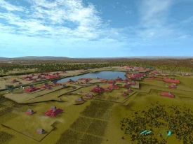
Chichén Itzá is an extensive archaeological city in the municipality of Tinum, in Mexico’s Yucatán state. Its name is commonly rendered as “at the mouth of the well of the Itza,” a reference to the region’s natural water sources and the people associated with the city. The ruins occupy a landscape where limestone bedrock, underground water and seasonal rainfall shaped settlement. The archaeological zone is not a single pyramid: plazas, platforms, temples, ball courts, residences and cenotes formed parts of a large urban and ceremonial center.
The city developed over centuries and became one of the most influential centers in the northern Maya lowlands. UNESCO describes Chichén Itzá as a place where Maya traditions and elements linked with central Mexico came together. That mixture is visible in architecture and imagery, but its meaning remains a subject of archaeological interpretation. It is more accurate to describe a history of contact and changing political relationships than to reduce the site to a simple story of one people conquering another.
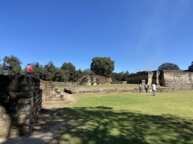
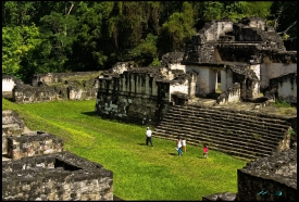
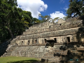
At the heart of the main plaza stands El Castillo, also called the Temple of Kukulcán. Its stepped profile and stairways dominate the open ceremonial space, while nearby structures include the Great Ball Court, the Temple of the Warriors, the Thousand Columns complex and the platform known as the Tzompantli. These buildings had different roles and were altered over time. The broad plaza gives visitors a sense of how architecture, ritual and public life were organized around shared open space.
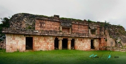
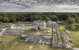
Beyond the central group, the site includes areas such as the Observatory, known as El Caracol, and the buildings around the Casa Colorada. The rounded form of El Caracol is unusual among the larger structures and has long invited questions about observation of the sky; its precise functions are interpreted from its architecture and context. A raised Maya road, or sacbé, links the main plaza northward to the Sacred Cenote, while another route connects the eastern area toward the Xtoloc Cenote. These paths show that the city’s spaces were linked rather than isolated monuments.
Architecture, water and archaeological interpretation
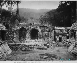
Chichén Itzá’s buildings display several architectural vocabularies. The INAH guide describes northern Maya features, including Puuc-style stone decoration, alongside forms often grouped under a Maya-Toltec label. UNESCO likewise notes a fusion of Maya construction traditions with elements associated with central Mexico. Researchers continue to assess how such resemblances arose through exchange, migration, political alliances or other interactions. Visitors will see the carved serpents, columns and relief panels; explanations should distinguish visible evidence from theories about who introduced particular ideas.
Water is central to the city’s story. In much of the Yucatán Peninsula, surface rivers are scarce and people relied on cenotes—natural openings into groundwater—as sources and places of cultural meaning. The Sacred Cenote lies north of the principal plaza and is connected to it by a sacbé. It is a protected archaeological feature, not a swimming attraction. The relationship between urban life and these water sources helps explain why the location mattered, while excavated objects and research provide evidence about its ceremonial use.
El Castillo is the best-known structure, but a visit that stops there misses much of the site’s texture. The Great Ball Court’s long parallel walls, the sculpted columns around the Thousand Columns complex, and the Observatory’s distinct silhouette each offer a different way to read the city. Some surviving buildings preserve traces of paint or relief decoration, though weathering and conservation affect what can be seen. Take time to look at the smaller platforms and routes as well as the most photographed pyramid.
Chichén Itzá was inscribed on UNESCO’s World Heritage List in 1988. The designation recognizes the archaeological city’s cultural significance and architectural record; it does not mean every structure is open to touch or climb. Conservation, visitor safety and the protection of fragile surfaces shape the route and access rules. Follow barriers and instructions from site staff, and treat the monuments as archaeological evidence rather than a backdrop for climbing or handling carved details.
The INAH material presents the site as a large, multi-period urban center, while UNESCO places it within a wider history of Maya and central Mexican interaction. These institutional summaries are useful starting points, but archaeology continues to refine chronologies and interpretations. A careful visit can hold both things in view: Chichén Itzá’s monumental architecture is immediately legible, while many questions about its inhabitants, political relationships and changing religious practices remain open to research.
Hours, admission and planning a visit
INAH currently lists the archaeological zone as open daily from 8:00 a.m. to 4:00 p.m., with last entry at 3:00 p.m. The federal admission charge shown is MXN 105 for both Mexican and foreign visitors, plus a separate Yucatán state CULTUR fee listed at MXN 190 for nationals and MXN 548 for foreign visitors. This makes the combined amounts MXN 295 and MXN 653 respectively before any applicable exemption or special condition. Fees and operating notices can change; confirm the official page and online ticket portal before travel.
The same INAH visitor information lists free admission for several groups, including Yucatán residents, children under 13, students and teachers, and older adults, subject to the applicable rules and proof of eligibility. The state charge and federal charge may have separate conditions, so do not assume an exemption covers every component without checking. INAH also notes a professional-camera fee and restrictions that include smoking, bringing food, pets and flash photography. Review the full current regulations rather than relying on a short summary.
The entrance is on Federal Highway 180, at kilometer 120, near Piste in the municipality of Tinum. INAH directions describe access from Mérida or Cancún via Highway 180, followed by the turn toward the archaeological zone at Piste. Travel time depends on traffic, tour schedules and where you are staying; allow extra time for the approach, parking and the walk from the entrance. A guided tour can add context, and INAH lists guided visits among the services available, but check the language, schedule and price directly before booking.
INAH lists visitor services including accessibility, lockers, parking, a cloakroom, an information desk, restrooms, a shop and guided visits. Their availability and exact location can vary, so arrive prepared and ask staff about current arrangements. The zone covers a substantial area, with open paths and limited shade in some stretches. Comfortable walking shoes, sun protection and water are sensible, while the rule against bringing food should be observed. Plan a realistic route instead of trying to see every structure at a hurried pace.
For a rewarding visit, arrive early enough to explore beyond El Castillo and leave time to understand how the plaza connects to the surrounding groups and cenotes. Chichén Itzá rewards a slower look: its scale is not only in the height of a pyramid, but in roads, courtyards, carved surfaces and the relationship between architecture and water. Check hours, the two-part admission cost and current restrictions on the official INAH site before departing, then let the archaeological landscape—not an oversimplified legend—guide what you notice.