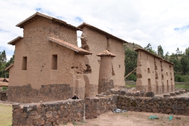
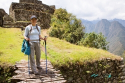
Waqrapukara does not announce itself like a city in a valley. It appears on a high sandstone outcrop in Peru’s Acomayo Province, where the rock rises above a ravine and the surrounding Andean landscape opens in several directions. The official tourism inventory places the archaeological site at about 4,300 metres above sea level and explains its Quechua name through two words: waqra, horn, and pukara, fortress. The resulting image is memorable, but the site is more than a dramatic profile: architecture, geology and approach routes all shape the experience.
The Cusco Culture Directorate records Waqrapukara as a pre-Hispanic archaeological monument classified as an archaeological landscape. Peru’s Ministry of Culture granted it National Cultural Heritage status by Vice-Ministerial Resolution 128-2017, dated July 17, 2017. That designation protects a place whose value lies not only in individual walls but in the relationship between built features, natural rock and the wide highland setting. Visitors should therefore read the whole ridgeline rather than treating the horn-like summit as a stand-alone photo point.