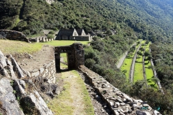
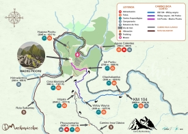
At roughly 3,500 metres above sea level, the Saywite Archaeological Complex sits in Curahuasi district, Abancay province, in Peru’s Apurímac region. The familiar image is a carved granite boulder, but the destination is a broader archaeological landscape: stone features, stairways, water channels and platforms occupy a setting reached by a side road from the Abancay–Cusco highway. The altitude and the route matter as much as the famous monolith when planning a visit.
Official descriptions do not always use the same boundaries or vocabulary. Peru’s Ministry of Culture’s 2022 notice described five sectors within a protected archaeological polygon of about 16.86 hectares; the tourism inventory describes an area of about 60 hectares and, in its current expanded description, refers to six sectors. These figures may reflect different inventories or definitions of the wider complex. They should not be collapsed into one supposedly precise measurement without a site plan that reconciles them.