About Watoqto
A highland site facing the eastern valleys
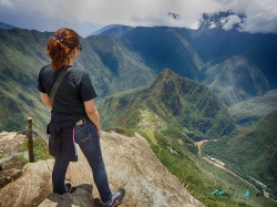
Watoqto is an archaeological complex in Colquepata District, Paucartambo Province, in Peru’s Cusco region. Peru’s Ministry of Foreign Trade and Tourism places it at about 2,930 metres above sea level, in the Quechua ecological zone. Its setting matters: the complex stands along a transition from the Andean highlands toward the forested eastern valleys, a landscape that shaped movement, exchange and political reach.
The national tourism inventory interprets Watoqto as an important Inca administrative and ceremonial centre, and a point of control associated with Antisuyo, the eastern quarter of the Inca realm. It also connects the site with routes toward Qosñipata, where coca was cultivated in the Inca period. These are the inventory’s historical interpretations; they place Watoqto within a regional network rather than proving that the ruins served only one purpose.
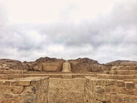
The complex is organised into three sectors identified in the inventory as Ceremonial, Saqsaywaman and Pachatuzan. Its remains include temples, ceremonial and domestic enclosures, platforms and retaining walls. The mix invites a more careful reading than the familiar image of an isolated temple: ritual, residence, landscape management and movement may all have formed part of the place’s role.
Architecture, water and the evidence on the ground
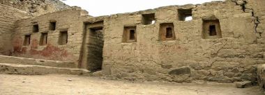
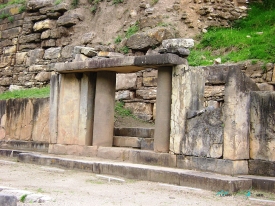
A double-jamb doorway leads to a large rectangular temple with trapezoidal niches, according to the MINCETUR record. Nearby buildings have rectangular or square plans and varying dimensions. Some walls are finely laid, while other sections use pirca-style stonework. Inclined wall faces and stepped platforms reflect Inca construction practices, but the visible fabric also includes later damage and repair; visitors should not mistake every surviving feature for a complete original structure.
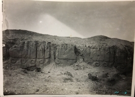
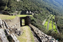
Retaining walls, some described as four to five metres high, follow the spur in stepped lines. Their placement helps explain how builders worked with the slope rather than flattening it. A round structure called “Qosqo” is also noted beside the principal complex in the tourism inventory. The record does not settle every interpretation of the buildings, so the site is best approached through what can be observed and documented, not through an invented story about a single ceremony.
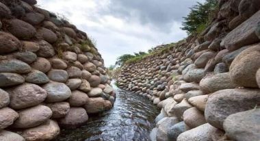
Water infrastructure expands the picture beyond the visible enclosures. MINCETUR records intake points for two pre-Hispanic aqueducts about 2.5 to three kilometres west of the complex. The channels followed the upper slopes on both sides of the Pichihua River, with Inca retaining works. The remains suggest that Watoqto’s wider landscape was managed through water and engineering; they also show why a visitor should not focus only on the temple façades.
Watoqto was declared Cultural Heritage of the Nation in 2010 by National Directorial Resolution No. 0137-INC. The inventory says that the former National Institute of Culture restored the complex and that the Cusco Decentralised Directorate of Culture is responsible for cleaning and care. This official status does not automatically mean that the site has staffed visitor facilities, a maintained interpretive trail or a published daily opening schedule.
Regional context and a realistic approach
Finds from Watoqto can be placed in a wider context at the Museum of the Peoples of Paucartambo. Peru’s Ministry of Culture says the museum preserves and displays archaeological objects from Watoqto, Plaza Kancha and Ninamarka, as well as ceramics and textiles made by present-day communities. Seeing those materials alongside the site helps connect architecture with settlement and regional cultural life, rather than treating the complex as a stand-alone ruin.
Access requires planning. The MINCETUR route inventory describes a journey from Cusco to Paucartambo of roughly 102 kilometres, then about eight kilometres toward Colquepata and another 10.4 kilometres on an unpaved vehicle track toward Watoqto. It lists estimated times, but those are route references, not guarantees: mountain weather, road maintenance, traffic and vehicle type can all change the journey.
There is no reliable current daily opening timetable, ticket price or staffed service schedule in the official inventory. The site’s 2019 visitor register recorded 245 local excursionists, 15 foreign visitors and eight domestic tourists; those figures are historical and should not be presented as current attendance. The same record’s limited data reinforces the need to confirm access with the Culture Directorate or local authorities before travelling.
Do not assume that food, toilets, mobile coverage, drinking water or emergency assistance will be available at the complex. Arrange suitable transport locally, carry water and food, dress for sun and rain, and allow time to adjust to altitude. Stay on existing paths, avoid climbing walls and leave stones, pottery and plants in place. If the route or weather is uncertain, postpone rather than attempting an unverified shortcut.
Reading Watoqto beyond a ruin
The site’s value lies in its position as much as in individual buildings. The highland route, the eastern valleys, the three sectors, the terraces and the aqueduct evidence show a place embedded in a wider landscape. The MINCETUR inventory offers a useful starting point, but it is not a substitute for archaeological interpretation on site, and its access data may not reflect present road conditions or management arrangements.
Travellers can make a more meaningful day by combining advance coordination for Watoqto with a visit to the Paucartambo museum, if its current opening schedule allows. The museum’s collection links Watoqto with other Inca-period settlements and present-day craft traditions. Confirm both visits separately; neither should be assumed open simply because it appears in an online directory.
For visitors prepared for the altitude and the unpaved approach, Watoqto offers a quieter encounter with Inca architecture than the region’s busiest sites. Its story is not a reconstructed legend but a set of documented clues: doorways, niches, platforms, water channels and a strategic location. Respectful travel begins by checking access, then letting the evidence—and the surrounding landscape—guide the visit.