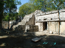
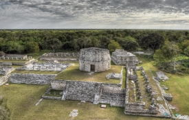
Chacmultún (Mayan: red stone hill) is an archaeological site of the Mayan culture located in the modern town of Chacmultun. It is located approximately 120 km southeast of Mérida, capital of the state of Yucatán, in Mexico. Chacmultún is located in the Puuc region in the municipality of Tekax, seven kilometers southwest of the Tekax headwaters. The archaeological site is located at an altitude of 60 meters above sea level.
The ancient city of Chacmultún, from the last Mesoamerican Preclassic period, has an area of one square kilometer, and is made up of four districts: Chacmultún (red stone hill, in Mayan language), Cabalpak (low terrace), Xetpol (severed head) and the Central district. In each one there is a group of buildings built on hills or old terraces that make them more imposing. Apparently, the city served as a link with other cities in the area, such as Edzná, Oxkintok, Uxmal and Kabáh, and the site was occupied until the 15th century.