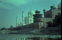
Humayun’s Tomb is often photographed as a single red-sandstone monument framed by lawns. The UNESCO property is much larger: a garden-tomb landscape in Nizamuddin that gathers several sixteenth-century structures, gateways and the remains of a Mughal-era settlement for craftspeople. The central mausoleum matters not only because of its scale, but because it helped establish a form of imperial architecture that later reached another celebrated expression at the Taj Mahal. To understand the place, look at the garden as carefully as the dome. Water channels, paths, subsidiary tombs and later conservation all belong to the story.
Humayun, the second Mughal emperor, died in 1556. UNESCO dates the construction of his tomb to the 1560s and describes the project as supported by his son, Emperor Akbar; Delhi’s official tourism account also identifies his widow Bega Begum as the patron who commissioned the mausoleum. Those accounts should be read together rather than reduced to a romantic legend. The structure was completed around 1570, bringing Persian and Indian craftsmen into a monumental project that marked an early, influential stage of Mughal architecture. Its setting and scale made the ruler’s burial place part of a carefully planned dynastic landscape.