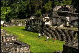
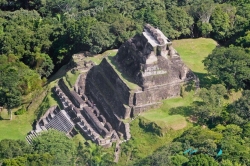
Hormiguero is a small, remote Maya site southwest of Xpujil whose elaborate façades reward travellers prepared for a rural road. The settlement belongs to the Río Bec region, known for buildings with paired false towers, high-looking stair motifs that cannot be climbed and entrances framed as the open mouth of a supernatural being. Dense vegetation and limited visitor infrastructure create intimacy, but also demand self-sufficiency.
The modern name came from an early twentieth-century chicle camp near the ruins. Carnegie Institution explorers Karl Ruppert and John Denison reported the site in 1933. The visible architecture flourished mainly in the Late Classic period, broadly between the seventh and tenth centuries. It formed part of a populated regional landscape rather than an isolated ceremonial outpost.