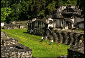
Calakmul lies deep in the southern Campeche forest, near Mexico’s border with Guatemala. The archaeological zone is part of a much larger cultural and natural landscape: UNESCO’s World Heritage property covers 331,397 hectares, with a surrounding buffer zone of 391,788 hectares. The forest can make the ruins feel remote, but the ancient city was once a major centre connected to settlements across the Maya lowlands by roads, political alliances and trade. Its setting is essential to the story, not merely scenery around a pyramid.
The name Calakmul is commonly translated as “two adjacent mounds,” a reference to the monumental structures rising above the canopy. INAH describes an occupation reaching back about twenty centuries before the Common Era, while the city’s most influential political period came much later. The archaeological zone extends across roughly 70 square kilometres and contains more than 6,000 structures, according to INAH. UNESCO’s broader protected property includes the ancient city and surrounding tropical forests, so the scale of the visit and the scale of the heritage landscape are not the same thing.