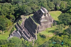
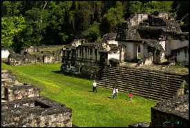
Altun Ha is the name given to the ruins of an ancient Mayan city in Belize, located in the Belize District about 50 kilometres (31 mi) north of Belize City and about 10 kilometres (6.2 mi) west of the shore of the Caribbean Sea. The site covers an area of about 8 square kilometres (3.1 sq mi). Stones from the ruins of the ancient structures were reused for residential construction of the agricultural village of Rockstone Pond in modern times, but the ancient site did not come to the attention of archeologists until 1963. The Old Northern Highway connects Altun Ha to Belize's Northern Highway, and the site is accessible for tourism. The largest of Altun Ha's temple-pyramids, the "Temple of the Masonry Altars", is 16 metres (52 ft) high. A drawing of this structure is the logo of Belize's leading brand of beer, "Belikin".