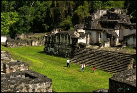
Kohunlich is a large Maya settlement set within tropical forest west of Chetumal, close enough to reach on a day trip but far from the busiest tourism corridor. Its surviving ceremonial complexes, residential groups and raised roads occupy only part of an ancient urban area estimated at about 14 square kilometres. The encounter is therefore not with an isolated pyramid, but with a city whose buildings and circulation routes developed over many centuries.
The ancient name of the settlement is unknown. The modern name is generally traced to the English expression “cohoon ridge,” a reference to the local coroz palm. Archaeologist Raymond Merwin reported the site after visiting in 1912, while later Mexican research progressively clarified its chronology and architecture. Evidence places early occupation in the Late Preclassic period, approximately 300 BCE to CE 250, followed by major construction and an urban peak during the Classic period.