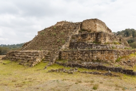
El Tajín lies near Papantla in northern Veracruz, where the Gulf coastal plain meets foothills and streams. It is not a single pyramid set apart from its surroundings: UNESCO describes a pre-Hispanic urban landscape of plazas, temples, residences and public buildings arranged across different ground levels. The settlement’s relationship with the hills and waterways is part of what makes the site legible to visitors today.
The chronology requires care. INAH presents a broad archaeological sequence from about AD 300 to 1200, with the Epiclassic period from 600 to 900 as a principal frame. UNESCO’s current summary describes occupation from roughly 800 to 1200, reflecting newer research that revised older, multi-phase models. These dates are not a reason to flatten a complex history: they show how archaeological interpretations change as evidence is reconsidered.