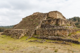
Cantona stands on a rough volcanic field, or malpaís, between the highlands of central Mexico and the Gulf of Mexico. Instead of avoiding the uneven terrain, its inhabitants turned it into a fortified city of terraces, walled residential compounds, plazas and interconnected streets. The National Institute of Anthropology and History (INAH) describes Cantona as a major pre-Hispanic centre that controlled a commercial route between the plateau and the coast. The site is not a single ceremonial pyramid: its defining feature is an urban fabric spread across a large, difficult landscape.
INAH counts around 4,000 connected streets across the city. Archaeologists have documented at least 2,700 residential units in the southern sector, the portion most closely studied, and estimate that Cantona may once have contained about 7,500 units and a population of just over 90,000. These are archaeological estimates extrapolated from surveyed areas, not a complete census. Many houses stood within compounds enclosed by perimeter walls; their size and arrangement varied, revealing differences in status as well as the organization of daily life.