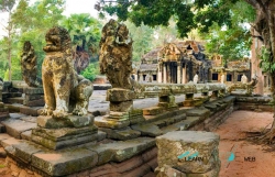
Banteay Samre stands east of the embankment that formed the eastern edge of the East Baray, the great reservoir in the Angkor region of Cambodia. The APSARA National Authority places it slightly away from the best-known temple route, reached through countryside of villages and rice fields. That setting is part of its appeal: the approach moves from the busy core of Angkor toward a more open agricultural landscape, without making the monument any less connected to the Khmer capital.
APSARA dates the temple to the middle of the 12th century, shortly after Angkor Wat, and identifies it with the reign of Suryavarman II. The Ministry of Tourism describes the temple as Hindu and associated with Vishnu, while APSARA’s temple account discusses its Hindu character and its architectural relationship to Angkor Wat. These sources agree on the broad period and style; inscriptions are less abundant than at some other Angkor monuments, so the building itself carries much of the historical evidence.