Puyehue-Cordón Caulle, Chile: volcanoes, forests and visitor guide
In Chile’s southern Andes, Puyehue-Cordón Caulle is both a volcanic complex and a name associated with a wider landscape of forests, lakes and protected land. The distinction matters to visitors: the volcanic features are not a single viewpoint or a self-contained attraction, and the national park is not permission to approach an active crater. The most practical starting point for a trip is the official visitor information for Puyehue National Park, whose three sectors—Aguas Calientes, Anticura and Antillanca—offer very different ways to encounter this part of the Andes.
A volcanic landscape shaped over time
SERNAGEOMIN, Chile’s national geology and mining service, describes Puyehue-Cordón Caulle as a complex of connected volcanic centers in the Andes, across the Los Ríos and Los Lagos regions. Its components include the Cordillera Nevada caldera, the Puyehue stratovolcano and the fissure system of Cordón Caulle, alongside smaller volcanic centers. These names refer to related but distinct landforms. A map pin marked “Puyehue-Cordón Caulle” therefore should not be read as a precise trailhead, public access gate or promise of a clear view of every summit.
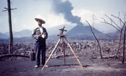
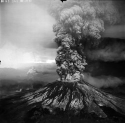
The terrain records a long sequence of volcanic activity. Geological descriptions list lava flows, cones, craters and other forms produced over hundreds of thousands of years. The complex has erupted repeatedly in historical times: SERNAGEOMIN highlights episodes in 1921–22, 1960 and 2011–12. The Cordón Caulle eruption began on 4 June 2011 and continued into 2012, producing ash and lava. The 1960 episode followed the great Valdivia earthquake, a reminder that this is a dynamic region whose story is written by interacting geological forces rather than by a single dramatic event.
That history is compelling, but it is not a reason to seek the closest possible approach. Volcanic activity can affect air quality, roads and access well beyond the visible crater, and local conditions change. This article describes the landscape and the managed national park, not a route to an eruptive center. Visitors planning a hike or mountain excursion should check the current SERNAGEOMIN monitoring information and CONAF notices, follow ranger instructions, and treat any closure or warning as decisive.
Inside Puyehue National Park
The national park protects a much broader natural setting than the volcanic complex alone. CONAF states that Puyehue National Park was created in 1941, expanded in 1950 and given its present boundaries in 1981. It covers about 112,755 hectares across the provinces of Valdivia and Osorno and the communes of Río Bueno, Lago Ranco, Puyehue and Puerto Octay. The agency divides the park into Aguas Calientes, Anticura and Antillanca. Its humid evergreen forest, sustained by heavy rainfall, is one of the defining features of the area.
The forest changes with elevation. CONAF’s park profile names trees including ulmo, coigüe, olivillo, tineo, tepa, mañío, lenga and Magellanic coigüe, with a richly layered understory of shrubs, ferns, mosses and lichens. The agency reports more than 130 bird species and lists mammals such as puma, güiña, pudú, monito del monte and coipo. Those are park-wide records, not a guarantee that a visitor will see a particular animal. The useful way to experience this biodiversity is to move quietly, stay on authorized paths and give wildlife space.
Aguas Calientes is associated with thermal waters and visitor services; Anticura and Antillanca provide other gateways into the park’s forest-and-mountain setting. CONAF identifies concessions in Aguas Calientes and Anticura, and notes that accommodation and food are available in some nearby locations while the town of Entre Lagos is about 30 kilometres from Aguas Calientes. Services are not evenly distributed across the park, so do not assume that a shop, meal or phone signal will be available at every trail entrance. Check directly with the operator if a thermal bath, lodging or other paid service is central to your plans.
Hours, access and practical planning
At the time of review, CONAF’s official Puyehue page lists the park as open every day from 9:00 a.m. to 5:30 p.m. It says there is no reservation system and that entry to trails is free, except for concession-operated routes including El Indio, Repucura and La Princesa. Long-distance trails require prior authorization from the park administrator. These are operational details that can change with weather, maintenance, staffing or safety conditions; confirm them on the official page before setting out, especially if you are travelling to a specific sector or planning a full-day walk.
The main road approach is International Route 215-CH, connecting Osorno in Chile with Bariloche in Argentina. CONAF directs visitors at kilometre 76 to the U-485 branch for Aguas Calientes and Antillanca. That route also serves international traffic toward the Cardenal Samoré border crossing, so allow time for road conditions and border queues if your itinerary crosses the Andes. The available official information does not establish a convenient public-transport connection to every trailhead; arrange transport in advance and confirm the final section of your route with the park or your accommodation.
Pack for rain and rapid changes in mountain weather, even when the forecast looks settled in town. Carry water, food, warm layers and a charged phone, but do not rely on mobile coverage. CONAF prohibits fires, pets, littering, disturbing or feeding wildlife, leaving marked routes, and drone use without authorization. Anyone planning a longer mountain outing must register with park staff and obtain the required approval. These rules protect visitors as well as fragile soils, waterways and forest habitat; they are part of the visit, not fine print to negotiate on arrival.
What makes a visit worthwhile
Puyehue-Cordón Caulle is most rewarding when approached as a living landscape rather than a checklist of volcanic peaks. A short forest walk, a carefully planned visit to one of the park’s sectors, or time spent understanding how volcanic ground, rain and evergreen forest shape the region can be more meaningful than chasing a distant crater view. The park is part of the Temperate Rainforests of the Southern Andes Biosphere Reserve, and its conservation story has been renewed through CONAF’s work with nearby communities and visitors.
Before travelling, check two separate kinds of information: CONAF for park openings, routes and visitor rules, and SERNAGEOMIN for volcanic activity. A national park schedule is not a volcanic safety forecast, and a quiet-looking skyline is not proof that conditions are unchanged. With that distinction in mind, the site offers a richer experience: a protected Andean forest, a record of major eruptions, and a reminder that travel here depends on respecting both the natural history and the current advice of the authorities who monitor it.