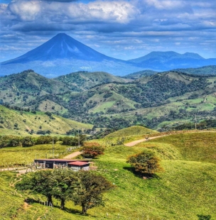
About Pico de Orizaba
Mexico’s highest protected mountain landscape
Pico de Orizaba, also called Citlaltépetl, is the highest mountain in Mexico, rising to 5,610 metres above sea level according to the current profile published by the National Commission of Natural Protected Areas (CONANP). The national park spans Puebla and Veracruz and protects a high-mountain environment as well as the volcano itself. This is not a conventional roadside viewpoint: the reserve covers a large, rugged landscape, and reaching a trailhead or refuge requires planning. Visitors may come for climbing, hiking, photography or the mountain scenery, but conditions change sharply with altitude and weather.
The park was decreed on 4 January 1937. CONANP’s current profile identifies municipalities on both sides of the state boundary and lists the protected area at 19,750.01 hectares. Its attractions extend beyond the summit: the agency names Sierra Negra, Valle del Encuentro, Cascadas de Hielo and several community ecotourism facilities among the places and activities in the area. High-elevation habitats support plants and animals adapted to severe conditions. The ecological value is one reason to remain on established routes and treat the park as a protected landscape, not as open terrain in which visitors can choose any path.
A mountain volcano that is monitored
Citlaltépetl is an active volcano in geological terms, but that description does not mean it is erupting now. In an April 2025 update, Mexico’s National Centre for Disaster Prevention (CENAPRED) said the volcano was not in an eruptive process and that its monitored baseline had shown no significant change since the agency’s permanent monitoring system began operating in 1998, in collaboration with the National Autonomous University of Mexico and the University of Veracruz. CENAPRED identifies 1864–1867 as the period of its last important recorded activity, when fumaroles and ash emissions were observed.
The distinction matters for visitors: a quiet period is not a reason to ignore official advice or approach the crater. CENAPRED says specialists monitor the volcano throughout the year and will report significant changes through official channels. The park’s height also creates ordinary but serious mountain hazards, including cold, wind, snow or ice, reduced oxygen and rapidly changing visibility. Check current notices from CONANP, CENAPRED and local civil-protection authorities before travelling; do not rely on a past trip report or an old web page as a safety assessment.
Approaches, entry and practical planning
CONANP lists five main approach routes: the north route from Tlachichuca, northeast from Coscomatepec, south from Atzitzintla, southeast from Orizaba and east from Coscomatepec. The profile gives approximate route distances of 20, 30, 12, 25 and 20 kilometres respectively. These are approaches through a broad protected area, not promises of a simple, paved drive to the summit. The agency says there is no public transport to the protected area; visitors need a private or rental vehicle or a tourism operator working from nearby towns. It recommends hiring a guide authorized by CONANP for movement on trails and tracks.
The current CONANP visitor page lists access every day of the year and advises visiting during daylight. It posts an entrance charge of 125 Mexican pesos per person per day, with exemptions and discounts for eligible visitors who can show valid credentials. Fees and access arrangements can change, and weather or conservation decisions can affect entry, so confirm the official page and local conditions close to departure. The same profile names Orizaba, Tlachichuca and Coscomatepec as nearby reference towns, but distances do not capture the time needed on mountain roads or unpaved approaches. Arrange transport and return plans in advance rather than assuming a regular bus or taxi will reach a trailhead.
Choose the right activity and leave a light footprint
CONANP recommends mountaineering from January through May and says hiking is possible throughout the year, but an activity’s season does not guarantee suitable conditions on a particular day. Veracruz’s tourism authority stresses prior physical preparation and specialized equipment for a climb, including mountaineering boots and clothing, helmet, crampons and an ice axe; it recommends specialist guides. State civil-protection advice adds practical steps: check the forecast and route conditions, register at an access point or refuge, tell someone your itinerary and expected return, carry water and appropriate equipment, and do not overestimate your fitness or experience. These are high-altitude routes, not casual walks.
For a lower-impact visit, use established trails, follow park staff instructions, carry out rubbish and avoid disturbing wildlife or plants. The protected-area profile names species such as the bobcat, coyote and horned lizard, alongside high-mountain trees and flowering plants; sightings are never guaranteed. A visit can still be rewarding without a summit attempt: landscapes, forest transitions and community-run facilities are part of the experience. The best plan is the one that matches the day’s conditions and the group’s ability. Treat the mountain with care, verify operational information before setting out, and let the scale of the protected landscape—not a rushed summit checklist—shape the journey.