Popocatépetl, Mexico: volcano views, Paso de Cortés and safety guide
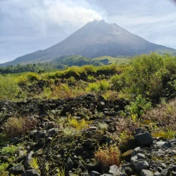
Popocatépetl dominates the skyline between Mexico City and Puebla, but the active volcano is not a mountain to climb. The rewarding visitor experience is at authorized parts of Iztaccíhuatl-Popocatépetl National Park, especially the high pass known as Paso de Cortés, where the landscape and the two volcanoes can be appreciated from a safe distance when access is open. As of CENAPRED’s 2 October 2026 bulletin, the volcanic alert stood at Yellow Phase 2 and authorities reiterated a 12-kilometre exclusion radius around the crater. Conditions can change quickly; a park visit never gives permission to enter a closed zone or approach the summit.
A living volcano in a protected landscape
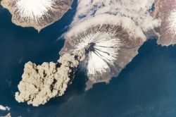
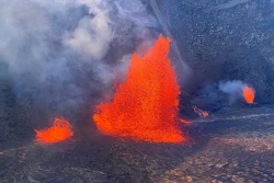
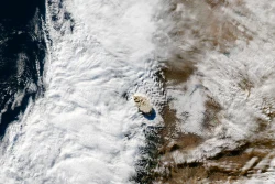
Popocatépetl is one of Mexico’s most active volcanoes and part of the Sierra Nevada, the mountain range that separates the Valley of Mexico from Puebla. Its profile is visible from a wide region, but distance can be deceptive: ash, falling incandescent fragments, sudden explosions and rain-triggered mudflows are real hazards. CENAPRED monitors the volcano around the clock and publishes dated activity reports. The alert level is operational information, not a forecast that guarantees calm conditions. Check the newest bulletin and civil-protection instructions before travelling, and obey any closure immediately.
The surrounding national park protects more than a dramatic skyline. CONANP explains that the protected area was created to conserve the mountains, forests, soils and watersheds that supply communities across central Mexico. The park decree for Iztaccíhuatl and Popocatépetl dates to 1935; the wider park landscape was later managed with adjoining protected lands, and UNESCO designated the Los Volcanes Biosphere Reserve in 2010. At lower elevations, pine and other mountain forests shelter wildlife and support water capture. Above them, volcanic slopes and alpine grasslands create a stark transition in climate and vegetation.
The name Popocatépetl is commonly rendered from Nahuatl as “Smoking Mountain,” a description that remains apt when a plume rises above the crater. The volcano is also woven into regional histories and cultural memory, but a visitor should distinguish those stories from present-day safety advice. The most meaningful view is not a claim of proximity to the crater; it is an understanding of how communities, forests and water systems live beside an active volcanic landscape. On clear days the paired peaks and high plateau are striking, while haze, cloud and seasonal weather can conceal them entirely.
Paso de Cortés and what visitors can do
Paso de Cortés is the principal visitor meeting point in the park, at roughly 3,660 metres above sea level. CONANP describes picnic benches, interpretive facilities and short educational trails in the area. Options listed by the park include brief walks near the pass, a 500-metre trail about the volcano rabbit, and the longer Alpino route toward La Joya. These routes are in permitted public areas and are not approaches to Popocatépetl’s crater. Check with staff which trail sections are open on the day; park rules and volcanic safety restrictions take precedence over older travel descriptions.
The views from approved areas can include Popocatépetl, Iztaccíhuatl and, on clear days, other high peaks across central Mexico. At Paso de Cortés, the experience is shaped by altitude and weather as much as scenery. The air is thin, temperatures can be cold even when nearby cities are warm, and wind, rain, frost or snow can make paths difficult. Allow time to acclimatize, walk at a measured pace and turn back if anyone develops headache, dizziness, nausea or unusual shortness of breath. The park authority recommends suitable footwear, layered clothing, water and sun protection.
Hiking farther toward La Joya is a separate outing with greater physical demands. CONANP describes the Alpino trail as about seven kilometres one way from Paso de Cortés and estimates roughly four hours for the return, depending on a walker’s condition and pace. That information is a route reference, not a guarantee that the trail is open or advisable under current conditions. Do not confuse access to this authorized path with permission to climb the volcano. CENAPRED’s crater exclusion zone remains in force unless authorities change it, and local park staff may impose additional closures.
Access, hours and current restrictions
CONANP’s access guidance routes visitors from Amecameca or from the Puebla side toward Paso de Cortés. Its federal visitor page says there is no public transport to the pass itself, so travelers should arrange a private vehicle or authorized local service and confirm road conditions. The page reviewed for this article lists park access hours of 9 a.m.–6 p.m. Monday through Friday, 7 a.m.–6 p.m. Saturday and 7 a.m.–4 p.m. Sunday, with an admission charge of MXN 125. These are official published details, but fees, hours, vehicle reservations and access rules can change; verify them directly before setting out.
Travelers should treat the park and the active-volcano exclusion zone as different things. Paso de Cortés and designated trails may be open while approach routes nearer the crater remain prohibited. The October 2 CENAPRED notice specifically said not to approach or climb Popocatépetl and to respect the 12-kilometre radius because of the risk of incandescent fragments; it also warned visitors to avoid ravine bottoms during heavy rain because of mud and debris flows. Park entry is not permission to cross a barrier, hike toward the crater or ignore official instructions.
Plan transport and weather together. The road climbs to high elevation and can be affected by closures, repairs, fog, frost or snow. There may be no convenient public bus for the return, so agree on pickup time and location before leaving. Carry identification, water, food and warm layers; take all rubbish back out. Cell service may be unreliable. If an alert changes or park staff close a path, follow their directions rather than trying another route. Before departure, check CENAPRED for volcanic activity and CONANP for park admission, reservations and trail status.
Seeing Popocatépetl without taking needless risks
A visit to the Izta-Popo area is rewarding when the volcano is treated as a living system, not an adventure challenge. At a legal viewpoint, notice the contrast between the snow line, forest belt and open volcanic slopes, and consider how the park protects water sources as well as scenery. The most dependable itinerary is modest: verify the pass is open, stay within authorized public areas, choose a trail suited to the group and keep enough time for the descent. A clear view is never worth crossing a restricted boundary.
Popocatépetl’s presence makes this park unforgettable, but the same activity that gives the mountain its drama also demands caution. Alert levels, road access and trail openings are temporary facts, not permanent features of a brochure. Recheck the official bulletin on the day of travel, respect the crater exclusion radius and listen to park personnel. From Paso de Cortés, visitors can experience the scale of the volcano and the surrounding protected landscape while keeping a safe distance—the right balance for a place whose beauty and risk come from the same geology.