Mount Merapi, Indonesia: a living volcano and a protected landscape
A volcano at the heart of a populated landscape
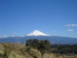
Mount Merapi stands on the border of Central Java and the Special Region of Yogyakarta, close to densely inhabited districts and a broad agricultural plain. The mountain is not simply a summit to climb: it is an active volcano whose slopes, rivers and surrounding communities are linked by both fertile soils and serious hazards. Its prominence in the landscape helps explain why Merapi is so present in regional life, but proximity should never be confused with permission to enter dangerous ground.
The surrounding Mount Merapi National Park protects about 6,410 hectares across parts of Central Java and Yogyakarta. Indonesia’s forestry authority describes its forests as important watersheds for nearby areas and as tropical ecosystems on an unusually active volcanic mountain. The park’s history reflects changing conservation designations, from protected forest and nature reserves to national park status in 2004. This protected area matters independently of summit tourism: it safeguards water functions, habitat and land that needs careful management.
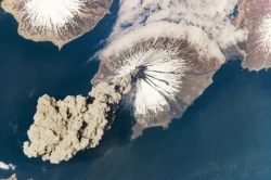
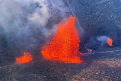
Merapi’s volcanic character is dynamic. Official geological reporting describes effusive activity, lava avalanches and the possibility of pyroclastic flows, while the mountain’s rivers can carry lahars during rain. Ash can also affect nearby communities and travel. These terms are not abstract technicalities; they describe hazards moving down slopes and drainage channels. Any account of Merapi that presents it only as a scenic trekking challenge leaves out the principal fact a traveler needs to understand.
Forest, geology and the human landscape
The national park profile describes forest lands managed for conservation, water catchment, botanical value and the aesthetics of a volcanic setting. Listed habitats include lower and upper mountain forest and subalpine zones. The wider landscape also contains cultivated slopes and settlements, so protected land sits alongside livelihoods and infrastructure rather than in isolation. A visit to the region may reveal this layered relationship between forest, agriculture, river valleys and urban areas, but access depends on official safety decisions.
Some official park materials identify wildlife and plant life associated with the conservation area, including the Javan hawk-eagle and Javan edelweiss. Such species are part of a wider ecological picture, not guaranteed sightings for visitors. The park’s conservation work also addresses the role of forest ecosystems in water management and the pressures of a highly active volcano. Remaining on authorized routes helps protect fragile habitat as well as keeping people out of places where volcanic danger can change quickly.
Merapi has shaped the region through repeated eruptions, deposits and river systems. Historical records and geological research document episodes of destruction and rebuilding, but simplified stories about a single eruption or a fixed cycle can mislead. The most useful way to read the landscape is to connect the mountain with the valleys and communities below it: volcanic material creates soils and landforms, while rain can remobilize deposits into hazardous flows. The same environment that supports agriculture also requires constant monitoring and preparedness.
Safety information is part of the destination
Volcano status and access restrictions can change, so all hazard information must be dated. On May 18, 2026, Indonesia’s Ministry of Forestry reported that BPPTKG still had Merapi at Level III, Siaga, and said climbing was not recommended; it also described illegal ascents as a continuing safety concern. This is a dated snapshot, not a guarantee for a later trip. Check the live MAGMA Indonesia portal and BPPTKG notices for the status and recommendations in force on the day you travel.
BPPTKG, the geological-hazard agency responsible for Merapi monitoring and mitigation, publishes activity information, hazard maps and monitoring resources. Its guidance should take precedence over social-media footage, old itineraries or an operator’s claim that a route is safe. A March 2026 weekly report, for example, documented continuing effusive activity and warned about lava avalanches, hot clouds, lahars and ash. The specific recommendations and restricted zones in that report were tied to that period and must not be reused as current boundaries.
For a planned visit, check the latest BPPTKG and MAGMA Indonesia updates, local disaster-management instructions and national-park notices on the same day. Do not hike toward the summit, enter a closed trail, approach river channels during hazardous conditions or cross a barrier to obtain a closer view. In May 2026, the Forestry Ministry explicitly said Merapi climbing was not recommended. Unless a current official notice clearly changes that recommendation and authorizes a route, this guide does not present summit climbing as a visitor activity.
How to learn about Merapi responsibly
There are ways to understand Merapi without treating the hazard zone as a challenge. The national park’s profile explains its conservation role and the way forest protects watersheds; BPPTKG offers monitoring resources and describes educational visits for students and the public. Those educational arrangements require direct confirmation with the agency. Ask which locations, dates and safety rules apply, and do not infer that an educational visit permits access to the summit or any restricted zone.
The town of Kaliurang appears in official updates as one of the places where authorities monitor conditions and communicate with visitors. That does not mean every nearby viewpoint, road or attraction is automatically safe or open. Confirm the exact location with local officials, heed closures and account for changes in weather. If an alert level rises, ash falls or authorities restrict access, postpone the outing. Travelers should also consider that conditions at the mountain may differ from those in Yogyakarta city.
Merapi is compelling precisely because it is both a natural force and a lived landscape. Its protected forests, rivers, farms and settlements tell a fuller story than a summit photograph, while the volcano’s current activity sets real limits on what visitors should do. Treat status reports as time-stamped, use the monitoring agencies as primary sources, and choose only activities that authorities currently permit. A responsible encounter may mean learning from a safe public area or an authorized educational program rather than climbing. Respecting that boundary is part of understanding the mountain.