Mount Kaguyak, Alaska: a caldera story in Katmai’s remote wilderness
A volcanic landmark, not a conventional summit visit
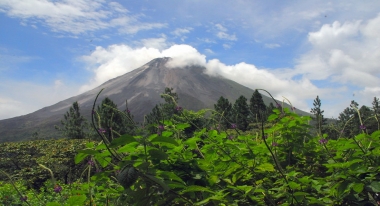
Mount Kaguyak stands in the northeastern part of Katmai National Park and Preserve on Alaska’s remote Alaska Peninsula. Its name is often attached to a dramatic mountain profile, but the most revealing feature is the broad collapse caldera and lake at its centre. The National Park Service describes Kaguyak as a caldera within a cluster of lava domes, rather than simply the familiar cone-shaped stratovolcano suggested by older summaries. That distinction changes how the place is understood: the lake, steep rim and islands record a sequence of volcanic construction, collapse and later growth.
Kaguyak is not a developed attraction with a road, visitor centre, marked approach trail or posted daily opening hours. It lies in a vast park where most travel between communities and visitor areas is by aircraft or boat, and the National Park Service cautions that Katmai cannot be reached by car. Information about the geological feature should therefore not be mistaken for a promise of ordinary access. For most travellers, Kaguyak is best approached first as a landscape to understand through reliable maps, official park information and, if arranging a flight, a properly authorized operator.
How the caldera and its islands formed
National Park Service and U.S. Geological Survey accounts place the caldera-forming eruption about 5,800 years ago. Before the collapse, the Kaguyak volcanic centre consisted of closely spaced lava-dome complexes; a major explosive episode emptied enough magma for the ground above to subside. The result is a steep-walled basin roughly 2.5 kilometres across. This is not a single instant frozen in stone but the visible outcome of a longer volcanic history, with earlier lava flows and periods of renewed activity documented by geologists.
Water now fills the depression, and the crater lake is about 500 feet, or 150 metres, deep according to the National Park Service. The islands rising from the lake are not unrelated bits of shore: they are lava domes that emerged after the caldera-forming eruption. Their presence makes Kaguyak especially legible as a geological sequence. First came the dome field, then collapse and explosive deposits, and later additional magma built new domes inside the basin. A visitor looking at a photograph can see the shape, but the sequence gives that shape its real interest.
What the evidence says—and what it does not
Older descriptions sometimes call Kaguyak a collapsed stratovolcano. Geological work cited by the Park Service refined that picture, describing nine distinct, closely spaced dome complexes in the ancestral volcanic centre. This correction is more than terminology: it replaces a simplified single-cone story with evidence for several neighbouring volcanic edifices and episodes. The National Park Service also notes that some of the dome rocks span a range of compositions, illustrating that the centre developed through more than one eruptive phase. A careful account should retain the uncertainty and evolving nature of scientific interpretation rather than turn a geologic model into a legend.
Official geological accounts have also reported gas bubbling at the lake surface, sometimes with a sulfurous smell. That observation belongs to scientific descriptions of the caldera; it is not a guarantee that a visitor on a particular day will see bubbles or smell gas. The depth figures, eruption age and interpretation presented here come from park and geological sources, not from measurements made by this guide. Nor should the lake be treated as a safe swimming destination: it is remote, deep, cold-country water inside wilderness habitat. The value of the place lies in reading its landforms and history, not in assuming that every feature can be approached safely.
Planning around Katmai’s remoteness
The National Park Service says Katmai is open year-round but has few services and no road access. Common journeys begin with a commercial flight to King Salmon, followed by an air taxi or water transport to the chosen part of the park. That general description does not establish a scheduled route to Kaguyak itself. The park’s public information does not provide a routine visitor timetable, public trailhead or standard excursion to the caldera. Anyone considering a flightseeing or wilderness trip should contact Katmai and an authorized commercial operator to discuss landing permission, weather, route feasibility and current conditions before making plans.
Katmai is bear country, and much of its backcountry has few maintained trails or facilities. The Park Service’s backcountry guidance asks visitors to prepare for route-finding, rapid weather changes and delayed transport; aircraft may be unable to fly when winds or low clouds intervene. Backcountry users need appropriate food storage, and bear-resistant containers are required for overnight travel. Travelers should file a trip plan with a trusted contact, carry suitable navigation and communication equipment, and avoid treating a scenic photograph as evidence that a site is easy to reach. A guide or pilot cannot eliminate the risks of remote Alaska, but an authorized operator can help assess them.
There is no reliable walk-in itinerary or fixed schedule to publish for Mount Kaguyak, and inventing one would mislead readers. The practical next step is to check the National Park Service’s current Katmai directions, backcountry safety information and commercial-services directory, then confirm details directly with the operator responsible for the proposed trip. Weather, aircraft availability, permissions and seasonal conditions can affect the plan. Visitors who are not arranging a specialized wilderness excursion can still learn about Kaguyak through official geological material and view it, when available, on a flightseeing route selected by an experienced local operator.
Kaguyak rewards attention because its outline is a record of change: a field of lava domes, a large collapse around 5,800 years ago, a deep lake and younger domes that now appear as islands. The revised geological interpretation corrects the old shorthand of a simple stratovolcano and gives the place a more accurate story. For potential visitors, the equally important fact is its setting in remote Katmai. Respecting that distance—checking official information and refusing to invent easy access—is part of understanding the mountain as it actually exists.