Chira Island, Costa Rica: a Gulf of Nicoya community shaped by water
An island in the upper Gulf of Nicoya
Chira Island sits in the upper Gulf of Nicoya, off Costa Rica’s Pacific coast in Puntarenas Province. The Costa Rican Tourism Board’s cultural tourism guide gives its area as about 4,300 hectares and names six communities: Puerto Bocana, Jícaro, Nancite, Pochote, Montero and Puerto Palito. That scale matters: Chira is not a single resort or viewpoint, but a lived-in island with settlements spread across a working landscape.
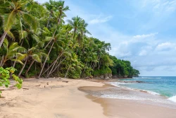
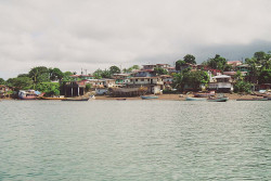
Water shapes the island’s geography and daily movement. Mangrove channels, Gulf shorelines and small landing places link local life to fishing and boat transport. Visitors arrive not at an isolated monument but in a community whose routines depend on weather, tides, services and the availability of transport. The trip is therefore part of the experience, and a good plan leaves room for changes rather than assuming a fixed mainland-style schedule.
The official tourism guide presents Chira through activities such as cycling, beaches, sport fishing, trails, local tours and visits connected with mangroves and mollusks. These listings introduce the kinds of experiences associated with the island; they do not guarantee that every excursion or provider is operating on a particular date. Contact local operators before traveling, confirm what is actually available and ask how long the activity takes.
Chira is often described through its natural setting, but the human geography is equally important. The named communities are not interchangeable visitor stops. Each is part of a broader island network, and a respectful trip recognizes that homes, docks and work areas are not attractions by default. Ask before photographing people or entering private property, and follow local guidance around fishing sites and sensitive coastal habitats.
Work, memory and the island’s changing economy
Artisanal fishing has long been central to livelihoods in the Gulf of Nicoya. Costa Rica’s fisheries institute, INCOPESCA, documents community fisheries-management work associated with the island and the importance of responsible use. Fishing is not simply scenery for a visitor: it is work, food and local knowledge. Respect landing areas and do not interfere with nets, boats or the daily tasks of people who depend on the water.
Local tourism offers another way for residents to share knowledge and diversify income. The tourism guide points to guided nature experiences, cycling and activities linked to mangroves and mollusk gathering. These possibilities are most meaningful when arranged with a legitimate local guide or provider, whose knowledge can explain how the shoreline, tides and livelihoods connect. Availability, prices and departure times should be verified directly rather than inferred from a general brochure.
Chira’s name is also associated with a Chorotega princess in an Indigenous legend recorded by the tourism guide. The account belongs to local cultural memory, not to a fully documented biography. It can be mentioned as a tradition while preserving that distinction: folklore may enrich a place’s identity, but it should not be presented as proven historical fact. Visitors can ask local guides how islanders tell the story today.
The island’s administrative and community history is more concrete but still deserves care. An official gazette record identifies Isla de Chira as a district of Puntarenas and names settlements within its territory. Population figures in older documents are not current counts; avoid using them as present-day statistics. What remains useful is the recognition that Chira has distinct local communities and governance, rather than being an uninhabited nature reserve.
Arriving by boat and planning practical details
Boat routes connect Chira with the mainland, including Costa de Pájaros and Puntarenas. Costa Rica’s public-services regulator, ARESEP, lists the authorized operator and maximum fare for the Chira–Costa de Pájaros route: as of its schedule effective July 1, 2026, the listed fares were ₡2,000 for adults and ₡200 for children. These amounts are dated regulatory information, not a promise that the same price or service will apply on a future travel day.
The ARESEP page also lists the Puntarenas–Chira service and an operator, but that route’s fare entry references an older resolution. Confirm the route, departure point, operating day, fare and return options directly with the operator before setting out. Boat services can be affected by weather and demand; do not assume a mainland bus timetable guarantees a same-day connection to the island.
Bring enough cash or a confirmed payment method, drinking water, sun protection and any personal medication you may need. Services are more limited than in a large city, and visitors should not count on finding every supply once they arrive. If arranging a guided activity, agree in advance on the meeting place, duration, equipment and what happens if weather or tides make a departure unsafe.
There is no reliable basis in the sources reviewed for publishing a universal visitor-center schedule, island-wide opening hours or fixed promotional package. Ask each provider for current details and build flexibility into the day. Check the latest marine-weather information, keep the return crossing in view and avoid traveling in a way that leaves local residents to solve a preventable transport problem.
Experience Chira as a community, not a checklist
The strongest visit may be less about collecting named stops than noticing how the Gulf organizes life. A landing, a mangrove edge and a fishing boat reveal different parts of the same relationship between water and work. A local guide can add meaning that a short visit alone may miss, while visitors who move quietly and ask permission help keep the exchange respectful.
Ecological settings deserve the same care. Mangroves and coastal waters support wildlife and livelihoods, and the guide’s activities should be understood within that fragile environment. Stay with an authorized route, do not leave rubbish, and do not collect shells, plants or animals. If a boat operator or guide postpones a trip because of conditions, treat that decision as a safety measure, not an inconvenience to overcome.
Travelers looking for luxury infrastructure or an always-on excursion desk may find Chira more modest than a developed resort area. That is not a deficiency to conceal; it is central to the island’s character and a reason to plan thoughtfully. The best expectations are practical: verify the boat, arrange local services, allow time for weather and approach the communities as places where people live and work.
Chira rewards visitors who arrive curious and prepared. Its Gulf setting, six named communities, artisanal fishing and mangrove-linked experiences offer a distinct view of Costa Rica’s Pacific coast. Use official tourism and regulator information as a starting point, confirm current arrangements locally and let the island’s rhythms set the pace. The visit becomes more revealing when the scenery is read alongside the people whose daily lives are tied to it.