Islands of Four Mountains, Alaska: volcanoes and Unangan history at the edge of the Aleutians
On a map, the Islands of Four Mountains look like a small knot in the long curve of the Aleutian chain. On the water, they are a remote volcanic landscape in the Alaska Maritime National Wildlife Refuge, far from the road network and the usual visitor infrastructure. Their appeal is not a promise of an easy island excursion. It is the chance to understand a place where living geological processes, a deep Unangan history and the realities of Arctic-maritime travel meet. For most readers, this is a destination to learn about before it is one to plan a conventional holiday around.
A landscape shaped by fire and sea
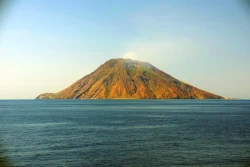
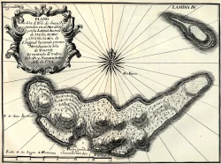
The group lies in the central Aleutians, west of the Fox Islands. Chuginadak Island is especially known for Mount Cleveland, an active volcano that rises from the island’s western side. The Alaska Volcano Observatory also tracks activity at Cleveland and publishes information about the region’s volcanic monitoring. A 2020 USGS study examined seismicity beneath Chuginadak and Tana using observations collected between 2014 and 2019, illustrating how scientists use sparse instruments and remote measurements to investigate a place where routine field access is difficult.
Volcanic activity is not a scenic detail to treat casually. The observatory’s Cleveland page displayed no new activity updates after July 8, 2024 when checked for this article on October 4, 2026. That is a clear reason not to repeat an old alert as if it were today’s condition. Anyone making a maritime approach would need to consult the Alaska Volcano Observatory and current marine and weather information immediately beforehand. Alert terms describe scientific assessments; they are not a guarantee that a remote shore landing is safe.
Weather and water are equally important to the experience. This is an exposed island environment, where fog, wind, swell and rapidly changing conditions can complicate navigation. There are no roads linking the islands to mainland Alaska and no ordinary visitor services such as hotels, cafés or staffed ticket entrances. A map pin or satellite image should not be mistaken for a public trailhead. The setting rewards geographic curiosity, but it demands planning by people with the appropriate vessel, local knowledge and emergency capacity.
Unangan history in a volcanic setting
The islands are part of the homeland and history of the Unangan, also known in older sources as Aleut. Archaeological work gives the place a human timescale that is easily overlooked in images of steaming mountains. A peer-reviewed study of the 2014 investigations documented Unangan occupation in the Islands of Four Mountains from roughly 3,800 years ago through Russian contact. Researchers mapped sites, examined cultural and geological layers, excavated house-pit features and studied local stone sources on Chuginadak and Carlisle islands.
That work is evidence of long-term knowledge and use, not a complete account of every community or every period. It also shows why archaeological remains should not be treated as curiosities to collect or disturb. The volcanic deposits that make the landscape scientifically valuable can preserve traces of earlier lives, while erosion and weather can expose or damage them. There is no visitor interpretation center on the islands; the research record, rather than on-site signage, is the best starting point for understanding the documented history.
The name “Islands of Four Mountains” can make the group sound like a single summit or a neatly defined park attraction. In practice, it refers to a cluster within the much larger Aleutian volcanic arc and a landscape with distinct islands and peaks. Mount Cleveland is among the best-known features, but it is not a substitute for the wider story: the archipelago’s Indigenous geography, the sea routes that connect it, and the scientific questions raised by volcanoes that are hard to monitor continuously.
What a visit can realistically mean
The U.S. Fish and Wildlife Service describes the Alaska Maritime refuge as a place generally reached by boat or aircraft; many refuge lands have no road access, and there is no scheduled air or boat service directly to most monument locations. Occasional commercial operators may offer boat-based trips in parts of the refuge, but that does not mean a departure is available to this island group on demand. Do not assume that an excursion seen elsewhere in the Aleutians includes a landing at Chuginadak, Carlisle or another island here.
For a prospective traveler, the responsible first step is to contact a qualified operator with current local experience and ask specifically about route, landing permissions, weather contingencies, emergency communications and the day’s volcanic information. The refuge’s broad visitor guidance is not a permit or an itinerary. There are no published opening hours, admission desk, food outlets or public facilities to plan around. If a trip cannot be arranged safely and lawfully, the observatory’s monitoring pages and the USGS research provide a meaningful remote way to follow the place.
Why the islands deserve attention
The strongest reason to care about the Islands of Four Mountains is the way several histories occupy the same ground. A volcanic arc is not an empty laboratory: Unangan communities lived with and understood this maritime environment over millennia. Modern researchers now combine archaeology, geology, seismic records and satellite observation to describe its changing landscape. The limits of access also shape what can be known, which is why published findings and cautious language matter.
For ordinary visitors, this is not a stop to add casually to an Alaska road trip. It is a remote refuge landscape where an attempted visit depends on specialist logistics and conditions that can change quickly. Read the current Alaska Volcano Observatory notices, follow refuge guidance and leave archaeological places undisturbed. Even from afar, the islands reveal a compelling meeting of deep human presence and active Earth processes—one best approached with curiosity, respect and a clear understanding of the risks.