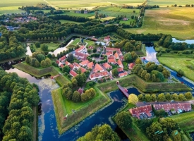
Middelbuurt, also known as Molenbuurt, was one of the settlements on the southern part of Schokland, the former island in the Zuiderzee. In Dutch it is described as a woonterp: a raised place where people built homes to stay above water. The mound belongs to the historic area of Ens, not to the northern settlement of Emmeloord. Today the landscape is strikingly different. Since the Noordoostpolder was drained, Schokland has stood amid farmland, an island in outline and elevation rather than surrounded by open sea.
The modern visitor should distinguish the historic settlement from the museum that now occupies the mound. Dutch Wikipedia records Middelbuurt as a disappeared village, with the nineteenth-century church and an iceboat shed among the structures that survived. The wooden buildings that house Museum Schokland are replicas in Zuiderzee style, built around the 1980s. That contrast is part of the place’s story: the site is not a preserved medieval village frozen in time, but an archaeological and cultural landscape whose surviving buildings, reconstructions and museum interpretation represent different layers.