Amsterdam’s canal ring is often reduced to a postcard of narrow houses reflected in still water. The real place is larger and more interesting: a living urban district whose canals, streets, bridges, homes, offices and public spaces grew together as one plan. Its UNESCO-listed core is officially called the Seventeenth-Century Canal Ring Area of Amsterdam inside the Singelgracht. The wording matters. It identifies a defined historic ensemble west and south of the medieval centre, rather than every canal or picturesque neighbourhood in the modern city. The landscape is still part of everyday Amsterdam, and that continuing use is central to what a visitor sees.
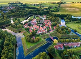
Water is the city’s setting, but also its infrastructure. The network made movement by boat possible, helped drain low-lying land and shaped the plots on which houses and civic buildings were raised. The UNESCO property covers about 198 hectares, with a buffer zone around it. Concentric canals, radial streets, old embankments and historic building lines remain legible, even as residents commute, businesses operate and visitors cross the bridges. Rather than searching for one entrance or a single monument, it is more rewarding to follow how the urban plan links one canal edge to the next.