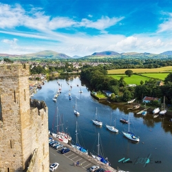
The Isle of Man sits in the Irish Sea between Great Britain and Ireland, but its identity is not simply a position between larger neighbours. Cliffs, beaches, wooded glens and upland peatlands give it a varied physical shape. Castles, mining machinery and a working parliament provide another map, made from the ways people have governed, defended and earned a living on the island. Following those connections reveals a destination with a distinct voice.
That distinction has a constitutional form. The island is a self-governing Crown Dependency, not part of the United Kingdom. Tynwald’s own explanation identifies a separate parliament, government, courts and power to make laws and raise revenue. Its relationship with the United Kingdom is maintained through the Crown. The familiar title Lord of Mann belongs to the British monarch, but the island’s public institutions have their own history and responsibilities.