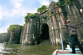
Van Fortress: tracing the Urartian capital above Lake Van
A citadel above the Van plain
Van Fortress rises on a long rock ridge overlooking the plain and the eastern shore of Lake Van. The Van Governorate places the site about five kilometres from the modern city centre and describes the natural outcrop as roughly 1,800 metres long, with steep southern faces and a gentler northern approach. Its height and commanding position explain the attraction of the ridge, but the setting is more than a scenic backdrop: the fortress was built to oversee the landscape around Tushpa, the Urartian capital that occupied this region.
The governorate dates the fortress’s foundation to Urartian king Sarduri I, around 840–825 BCE. In antiquity the capital was known as Tushpa. The official account describes the stronghold as a three-part complex and lists rock-cut foundations for walls, defensive circuits and towers. These remains should not be mistaken for one fully preserved palace. They belong to a long-lived fortified place whose surviving features record different phases of construction and use.
For a first-time visitor, the ridge is best read as both an archaeological site and a commanding piece of terrain. The approach climbs toward the northern side, while the southern slope drops more sharply. Looking outward helps explain the strategic choice of location; looking closely at cut stone and inscriptions reveals the labour and political authority behind it. The visit is rewarding when the landscape and the surviving evidence are considered together rather than as a single monumental façade.
Urartian inscriptions, tombs and sacred places
One of the most important Urartian features is the Madır, or Sardur, Bastion, associated with the dynasty that established the capital. The governorate’s heritage page also names rock-cut tombs connected with Argishti I, the founders, Menua and Sarduri II. These spaces show how the fortress combined political authority, burial practices and the shaping of the natural rock. The official listing is a useful guide to what is attributed to the Urartian period, although individual areas may be difficult to interpret without a site plan or local guide.
The open-air sanctuary known as Analı-Kız is another landmark identified by the provincial authority. Its setting in the rock makes clear that the fortress was not only a military position. Ceremonial and funerary features existed alongside the defensive architecture, and the site’s cliff faces preserve evidence that cannot be understood simply by looking at the skyline. The names and identifications are those used in official local heritage descriptions; they should not be expanded into unverified legends.
The “Thousand Steps,” also listed by the governorate, are part of the physical experience of reaching and moving through the fortress. Some paths are steep or uneven, so the visit calls for sensible footwear and a realistic pace. The natural ridge runs east to west and has sections of varying width, which helps explain why construction followed the contours instead of imposing a uniform plan. The terrain itself is part of the defensive design and of the visitor’s encounter with the site.
From Tushpa to later fortifications
Van Fortress did not stop changing when Urartian political power declined. The governorate notes a Persian inscription among the evidence from the centuries after the Urartian period, while several visible walls and buildings belong to much later phases. Eastern walls and towers, an entrance on the north-west side, the Upper Fortress, Süleyman Han Mosque and minaret, and military structures built from mud brick and stone are attributed to the Ottoman period in the official account. This layered record cautions against presenting every wall as Urartian.
The relationship between the fortress and the old city is also important. The governorate says the principal historic settlement developed south of the stronghold and was itself surrounded by walls. It reached the present with severe damage after 1915. The ancient ridge therefore stands beside a much wider urban history, including communities and architecture that do not survive in the same condition. Treating the citadel as the whole history of Van would erase that distinction.
Today the fortress is a place where several historical periods meet in a dramatic landscape. It can be tempting to reduce it to a single story of military conquest, but the record includes royal inscriptions, rock-cut tombs, sacred spaces, defensive works and later Ottoman structures. The strongest account is the one that separates documented remains from interpretation and recognizes that the same ridge served different purposes across centuries.
Visiting Van Fortress: hours, tickets and access
Van’s official visitor information places the fortress about five kilometres from the city centre. The provincial Culture and Tourism Directorate currently lists admission at €3 for foreign visitors; holders of a Turkish identity card may enter with a Müzekart. Fees can change, so check the official tariff before visiting. The Ministry of Culture’s seasonal notice for 1 May to 1 October 2026 gives Van Fortress a 7 p.m. closing time during that adjustment. Opening and closing arrangements outside that seasonal period can differ, and visitors should confirm the current timetable rather than rely on an old guidebook.
The site is an outdoor historic landscape rather than a climate-controlled museum. Expect exposed paths, changes in elevation and uneven stone underfoot. In warm weather, carry water and sun protection; in cooler or windy conditions, allow for the ridge’s exposure. Visitors with limited mobility should check access conditions with the local authorities before setting out, since a long rocky approach may not suit every visitor. Do not climb onto fragile masonry or enter restricted areas to obtain a view.
Allow enough time to see the fortress without rushing, and consider combining it with other historic places in Van only after checking their separate access and opening details. The governorate’s descriptions can orient a self-guided visit, but an authorized local guide may help distinguish Urartian remains from later additions. Before departure, verify the current ticket rules, seasonal hours, weather and any temporary closures with the provincial culture office. That simple check protects the visit from outdated online schedules and makes the archaeological landscape easier to appreciate.