About Popa Taung Kalat
A volcanic landmark in central Myanmar
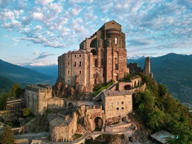
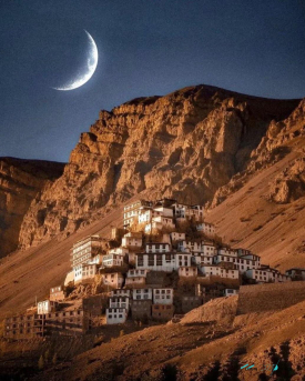
Taung Kalat rises as a steep-sided volcanic plug on the southwestern flank of Mount Popa in Myanmar’s Mandalay Region. The dramatic rock is often called a pedestal hill, a description that captures its shape: a narrow, sheer-sided summit above the surrounding plain. It belongs to the wider Popa volcanic landscape, an old volcanic complex whose forested high ground stands out in the drier central zone. The setting is striking, but the site is more than a viewpoint; geology, wildlife and living religious practice meet here.
Mount Popa and Taung Kalat are related but not interchangeable names. The first refers to the broader volcanic mountain and protected landscape; the second is the distinct rocky outcrop crowned by a monastery and shrines. Myanmar’s Ministry of Information describes Popa as an ancient volcano and records the area’s geological features as part of a national geopark. Keeping the names separate helps visitors understand the map: the sanctuary sits on Taung Kalat, while the protected natural area extends across a much larger region.
The central plain around Popa is comparatively dry, so the mountain’s vegetation and springs have long made it an ecological landmark. Government material identifies a mosaic of forest types and a notable range of mammals, birds, reptiles, amphibians and butterflies in Popa Mountain Park. The Ministry also reports more than 300 recorded plant species and highlights the Popa langur, a primate known from this area. These figures describe the protected landscape, not a promise that a visitor will see particular animals on a short walk.
From sacred summit to national geopark
Taung Kalat is a place of Buddhist worship and of devotion to the nats, spirits who occupy an important place in Myanmar’s religious culture. Shrines and offerings on the outcrop make that tradition visible in the landscape. The Ministry of Information’s Burmese-language account describes both the natural heritage and local cultural practices as part of Popa’s significance. Nat beliefs should not be reduced to folklore for visitors: they remain part of how communities understand sacred places and organize ceremonies.
Myanmar formally designated Mount Popa National Geopark through Notification 152/2023, effective 6 December 2023. The government described 15 geosites across 52,317.85 acres in Kyaukpadaung Township, including geological formations, natural features and cultural or historical places. The designation is national, not a UNESCO Global Geopark inscription. Government reporting in 2024 said officials were pursuing international recognition; that statement described an effort, not an approved UNESCO status. A careful account must preserve the distinction.
The geopark framework links conservation, learning and local livelihoods. Its official list includes the summit area, volcanic formations, viewpoints, a medicinal-plant garden and other sites across the wider region. That breadth matters: Taung Kalat is the most recognizable landmark, but it is only one point in a larger landscape shaped by geology and human use. A visit focused solely on a photograph can miss the context that makes the place significant, while an extended itinerary depends on access, transport and security conditions that may change.
Ritual life and the climb to the shrines
The approach to the monastery follows a steep staircase known locally as the Ruby Stairway. Myanmar’s tourism-police directory identifies a Popa sub-unit at the summit, in the trustees’ building by this stairway, confirming that the route is also a place of public administration and pilgrimage. The government source does not publish a dependable visitor timetable, ticket price or step count. Travelers should therefore avoid repeating numbers or hours from undated travel posts as if they were current official information.
People visit Taung Kalat for worship as well as scenery. A Burmese-language report by Myanmar’s Information and Public Relations Department documented a 2023 gathering honoring Boyo Min Khaung, associated with a date in the Myanmar lunar calendar. The report described crowds arriving over several days and congestion on the access road. That account is useful evidence of the site’s devotional role, but it is not a schedule for future years: lunar dates move against the Gregorian calendar, and ceremony arrangements can change.
At a religious site, practical courtesy matters. Follow instructions from caretakers, remove footwear where requested, dress modestly and do not treat worshippers or offerings as props. The climb is exposed and involves many stairs; visitors should consider their mobility, heat tolerance and footwear before setting out. Monkeys are present in the area, according to official descriptions of the park, but they are wild animals, not an attraction to feed or approach. Keep food secured and give animals space.
Current travel cautions and how to verify a visit
Travel advice is essential here, not a footnote. On 8 October 2026, the U.K. Foreign, Commonwealth & Development Office advised against all but essential travel to Mandalay Region, while advising against all travel to several other parts of Myanmar. The U.S. Department of State’s Burma advisory was more restrictive, at Level 4, “Do not travel,” because of armed conflict and other risks. These are dated national advisories, not a guarantee about a particular road or town; consult your own government’s latest guidance before making any plan.
Those warnings also affect insurance, transport and emergency planning. The U.K. government cautions that travel contrary to its advice may invalidate insurance. The U.S. advisory notes road hazards and disruptions from weather and earthquakes. Conditions can change quickly, and the location of a tourism-police sub-unit does not certify that a journey is safe or that the monastery is open. Do not infer access from an old map listing, hotel advertisement or social-media photograph. If travel is being considered, confirm locally through reliable, current channels and be prepared to cancel.
No reliable official public opening hours or admission price for Taung Kalat were located during this review. The government tourism-police directory lists a Popa contact number, but it should not be treated as a booking or access hotline without confirmation. The most responsible way to plan is to check current travel warnings first, then verify the road, local permissions, religious observances and access arrangements close to the intended date. Popa’s appeal is clear in its geology, biodiversity and sacred landscape; a meaningful guide must be equally clear that current conditions can outweigh the desire to see it.