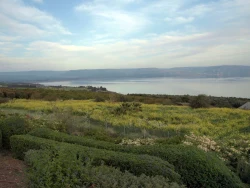
Coatetelco Lagoon: fishing, Tlahuica heritage and a changing shore
A lagoon at the heart of a living community
Coatetelco Lagoon is more than the blue space beside an archaeological destination in Morelos. Its shoreline connects fishing, food businesses and the daily life of an Indigenous municipality. The water gives the place its central subject: what people have taken from it, how they have lived around it and what must be protected if that relationship is to continue. A visit becomes richer when the lagoon and the town are read together.
The state tourism authority describes traditional mojarra fishing and boat outings among the lagoon’s attractions. These activities belong to a working landscape, rather than an entirely separate holiday resort. Around the shore, palapas link hospitality with the local economy. Their simple appeal is the possibility of lingering beside the water, but their future also depends on fishers, water management and the decisions made by residents.
That contemporary community deserves attention in its own right. Coatetelco is identified by the Morelos government as an Indigenous municipality, not merely as scenery surrounding ancient ruins. The archaeological site helps explain the depth of settlement here; it does not contain the whole history of the living town. Leave time for both, rather than treating lunch at the lagoon as a brief appendix to a visit elsewhere.
The older town beside the water
The neighbouring archaeological zone preserves temple platforms and a ballcourt. Its site museum presents material associated with the Tlahuicas and the changing relationships between this part of Morelos and larger centres of power. The INAH account places local history within a sequence that includes regional ceramic traditions, influence from Teotihuacán and eventual Mexica domination. These objects offer a more precise introduction than a single founding legend.
Look for the contrasts in the museum’s ceramics and figurines: material rooted in local production alongside pieces reflecting wider political and cultural connections. A sculpture of Xipe Tótec and a stone identified as a temalácatl introduce ritual aspects of the collection. The museum’s interpretation connects these finds with religious practices; the migration from Aztlán belongs to the traditional narrative it recounts, rather than a dated journey reconstructed from an eyewitness record.
The museum is on Amargura in the town centre, so the archaeological visit can lead naturally into the inhabited streets. Those streets are changing too. On 17 August 2026, the state government reported the renovation of around forty façades on Amargura through Rutas Mágicas de Color. This was a specific improvement to a corridor near the lagoon, rather than evidence that every tourism project proposed for Coatetelco had been completed.
The shoreline’s future depends on its water
Coatetelco’s appeal comes with environmental pressures. The municipal development plan published in October 2025 identifies declining water levels, pollution and sediment-related problems among the threats affecting the lagoon and fishing. That diagnosis describes challenges recognised by the municipality; it is not a laboratory report on the water on any particular day in 2026. Nevertheless, it explains why the health of the lagoon cannot be separated from the visitor economy.
On 18 March 2026, the Morelos government presented a plan to strengthen the shoreline palapas and improve their offer. Tourism, economic development, agriculture and the state water commission were involved. The announcement linked the care of the lagoon’s water environment with support for fishing and respect for Indigenous identity. Fish were released during the official visit, but that act alone could not establish the recovery of the entire ecosystem.
For travellers, the distinction between an announced plan and finished work matters. Ask locally what is operating, which shore areas can be entered and whether a boat outing is available that day. The tourism listing does not supply a fixed departure schedule or certify swimming conditions. Choosing local services and avoiding litter helps keep the visit connected to the community whose livelihood depends on this shared stretch of water.
Making room for the lagoon and the museum
One approach described by INAH follows Federal Highway 95 towards Alpuyeca and then the signed turn towards Coatetelco. Its reference to two kilometres from Alpuyeca concerns the turnoff, not a two-kilometre journey all the way to the lagoon. Check the final route before travelling. The museum and archaeological zone are separate places to enter from the shore, and neither provides automatic access across private land or working fishing areas.
Confirm the archaeological zone’s and museum’s current opening arrangements directly with INAH, particularly before travelling on a Monday or holiday. Published official listings differ on opening days, so building the whole day around an unchecked timetable is unwise. At a shoreline restaurant, ask what is being served and agree any boat price and route before boarding. Carry drinking water and take care on exposed or uneven sections beside the lake.
Coatetelco works best as a place to understand slowly: ancient objects, inhabited streets, fishing and a meal facing the lagoon each reveal a different relationship with the water. The most significant story is not simply that a visitor can pause beside a lake. It is that a living community is trying to maintain a productive landscape while making room for tourism, and that the landscape’s survival remains the condition for everything else.