Lake Tahoe, California and Nevada: clear water, history and visitor guide
A high Sierra lake shared by California and Nevada
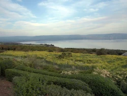
Lake Tahoe lies in the Sierra Nevada on the California–Nevada border, at a natural rim elevation of about 6,223 feet. The U.S. Environmental Protection Agency describes a lake roughly two million years old, covering 192 square miles and reaching 1,645 feet at its deepest point. It is the second-deepest lake in the United States after Oregon’s Crater Lake. Those facts are more than trivia: the altitude affects exertion, the basin’s scale shapes travel times, and the lake’s depth and clarity give the landscape its distinctive blue appearance. Tahoe is a region of many communities and public lands, not a single park with one entrance or schedule.
The Washoe Tribe’s ancestral homeland surrounds the lake. The EPA records the Washoe name Da ow a ga, translated as “edge of the lake,” and describes Tahoe as a sacred, life-sustaining water at the centre of the Washoe world. This perspective matters alongside the region’s familiar recreation story. The basin was extensively logged from the 1860s into the early twentieth century, and growth in homes, hotels, casinos, ski areas and roads later increased sediment entering the lake. The EPA links this development to algae growth and declining clarity, while noting that wastewater has been exported from the watershed since the early 1970s to reduce nutrient inputs. Conservation is part of the place’s present, not just its past.
Geology, water and a landscape to protect
Federal scientific summaries describe the Tahoe Basin as a fault-formed landscape created during the uplift of the Sierra Nevada around two to three million years ago. The basin covers about 501 square miles, with the lake itself occupying roughly 192 square miles. Sixty-three streams feed the lake, while the Truckee River is its only natural outlet, according to the EPA. The lake’s water level and clarity are monitored because the basin is both an ecosystem and a source of recreation and water. Its deep blue surface can look timeless, but water quality responds to development, stormwater, wildfire and other pressures across the watershed.
Nearly the whole lakeshore is divided among different public agencies, towns and private properties. California and Nevada state parks, U.S. Forest Service lands and local beaches each have separate access rules. Emerald Bay State Park on the west shore is one particularly recognizable place: the bay is glacially carved, and the park includes Vikingsholm, a Scandinavian-inspired summer home built in 1929, as well as Fannette Island. In Nevada, Sand Harbor combines coves, beach access, short trails and the paved Tahoe East Shore Trail. These examples help visitors choose a manageable area, but they are not interchangeable; distances, terrain, operating seasons and fees differ.
What visitors can do—and what to check first
At Emerald Bay, California State Parks lists the park and parking area as open from sunrise to sunset. The official page currently lists day parking at $10 per vehicle or $3 per hour, while warning that rates may change. Access to Vikingsholm requires a steep trail descending about 500 feet over one mile; there is no ride back up. The house is a seasonal tour attraction rather than a year-round indoor visit. As of the official 2026 update, tours and the visitor centre’s season ended on September 30, so travellers reading this on October 4 should not expect a tour that day. Check the current notice before planning a future visit, particularly because restoration work and seasonal closures can affect access.
Sand Harbor State Park’s Nevada listing gives general hours of 8 a.m. until one hour after sunset and day-use fees of $10 for Nevada vehicles and $15 for vehicles from outside the state. The park also states that vehicle reservations are required during a seasonal summer window, May 15 through September 30; that 2026 window has passed as of October 4, but the next season’s requirements should be checked before travel. The Tahoe East Shore Trail connects Incline Village with Sand Harbor and provides access to public beaches and coves along the Nevada shore. Parking can fill, and high visitation may lead to closures, so plan an alternative rather than stopping on the highway or assuming there will be space.
Planning a responsible Tahoe trip
There is no single opening time, entrance pass or operating calendar for Lake Tahoe. A day at the lake might involve a state park, a federal trail, a town beach, a boat launch or a historic house, each with its own hours and rules. Confirm the exact destination, current parking and admission charges, reservations, pet restrictions, trail conditions and any fire or watercraft advisories. Remember that a short map distance can involve steep terrain or high-altitude exertion. The hike to Vikingsholm, for example, descends to the shoreline and requires the same steep climb on the return; visitors with mobility or medical concerns should review the official warnings before attempting it.
A thoughtful visit sees Tahoe as more than a backdrop for summer swimming or winter sports. It is a living homeland for the Washoe people, a watershed sustaining communities, a geological basin and an ecosystem sensitive to how people travel and build. Use designated access, keep waste out of the water, respect fire restrictions and wildlife, and choose established trails rather than fragile shoreline vegetation. The lake’s immense depth and celebrated clarity invite wonder, but its protection depends on many small decisions across the basin. Whether the day is spent at a beach, an overlook or a historic site, checking current rules and learning whose land and water you are visiting makes the experience more informed and more rewarding.