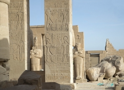
On the west bank of the Nile opposite ancient Thebes, today’s Luxor, a dry valley cuts into the desert hills. Egypt’s Ministry of Tourism and Antiquities identifies it as the burial ground used by rulers of the Eighteenth, Nineteenth and Twentieth Dynasties during the New Kingdom, roughly 1550–1069 BCE. The location is not an isolated point on a map: it belongs to a wider Theban funerary landscape, where the river, the western cliffs and the sacred geography of the setting shaped burial choices.
The familiar name “Valley of the Kings” is useful but not fully exact. The ministry notes that members of royal families and a small number of high-ranking non-royal people were buried here as well as kings. It also divides the site into the East and West Valleys. The eastern section contains the larger share of the famous tombs; the western arm has fewer. In all, the official profile records more than sixty tombs and about twenty unfinished tombs or excavations.