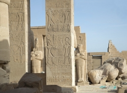
At Deir el-Bahari, on the west bank of the Nile opposite Luxor, Hatshepsut’s temple places an ordered sequence of terraces beneath a great wall of rock. The contrast gives the monument its force: repeated columns and long horizontal lines set against the irregular mass of the cliff. The building does not simply stand in front of the landscape. Its approach draws the eye into it, towards the sacred spaces cut deeper into the mountain.
The famous façade can make the wider place seem like the creation of one reign. It was not. Deir el-Bahari already possessed a major royal funerary complex centuries before Hatshepsut. Mentuhotep II, the Eleventh Dynasty king associated with Egypt’s reunification and the beginning of the Middle Kingdom, built here in the late third millennium BCE. UCL’s Digital Egypt chronology places his reign around 2046–1995 BCE, long before the fifteenth-century queen.