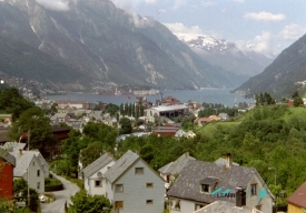
The photograph of Trolltunga is almost always taken from the same daring angle: a narrow tongue of rock projecting above a deep blue lake. What the image leaves out is the journey required to reach it. The formation sits high above Ringedalsvatnet in the Hardangerfjord region, and the approach crosses exposed mountain terrain for many hours. Trolltunga is not a roadside viewpoint but a serious hike whose reward is inseparable from preparation.
The official trail information places Trolltunga at about 1,180 metres above sea level. Starting from P2 Skjeggedal, the return route is 27 kilometres, with an estimated eight to twelve hours and about 800 metres of ascent. From P3 Mågelitopp, it is shorter—20 kilometres round trip and about seven to ten hours—but the upper car park is seasonal and has limited capacity. These are demanding mountain routes, not casual walks. Your pace, weather and trail condition matter more than an optimistic estimate.