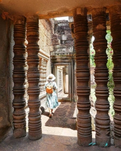
Preah Vihear occupies a dramatic plateau edge in northern Cambodia, where a long sequence of sanctuaries, paths and stairways follows the land toward an escarpment above the Cambodian plain. UNESCO describes the complex as dedicated to Shiva and organized along an axis about 800 metres long. Its history reaches back to a ninth-century hermitage, while the main temple complex dates chiefly to the first half of the eleventh century. The architecture is significant not only for carved stonework but also for the way the religious plan responds to the natural topography.
The setting has often shaped how people imagine the site: a temple reached through successive thresholds, with the landscape opening below. That image should not obscure the practical and political history of a working place of worship. The sanctuary was developed across different periods, and UNESCO emphasizes its series of linked sacred structures rather than a single isolated tower. Its carefully arranged approach, staircases and pavilions make the terrain part of the architecture, not merely a scenic background.