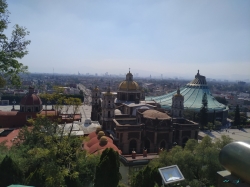
The Historic Cemetery of Tepeyac occupies a terraced site on the hill of Tepeyac in Gustavo A. Madero, northern Mexico City. The city’s 2024 heritage declaration places it inside the grounds of the Insigne and National Basilica of Santa María de Guadalupe. It is a civil cemetery, not a church interior or an ordinary public park, and its setting links funerary architecture with one of the capital’s most prominent religious landscapes.
The slope explains the cemetery’s unusual form. Mexico’s National Institute of Anthropology and History, or INAH, describes a layout shaped by the hill, with 27 platforms or terraces arranged across different levels. The city’s 2024 declaration gives the protected property an area of 16,192.69 square metres and also counts 27 terraces. INAH’s public catalogue lists 17,480 square metres for the ensemble. Because the official records use different area figures, this article preserves the discrepancy rather than choosing one as definitive.