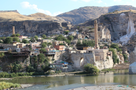
Diyarbakır Fortress is best understood as part of a living city. Its dark basalt ramparts trace the edge of Sur, the historic core of Diyarbakır in southeastern Türkiye, while the Tigris River and the green Hevsel Gardens open below the escarpment. The UNESCO-listed property joins these elements with İçkale, the Inner Castle, and the Amida Mound. The result is a cultural landscape: a defensive structure, an old urban centre, cultivated land and a river setting that make sense together rather than as isolated attractions.
UNESCO describes the city walls as 5.8 kilometres long, with towers, gates, buttresses and 63 inscriptions. That measured description is more dependable than popular superlatives that call the fortress the world’s oldest, tallest or second only to another wall. The fortifications have been repaired and altered over many centuries, so their significance lies in the accumulated record visible in their masonry and inscriptions, not in a claim that one dynasty built everything at once.