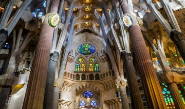
Barcelona rewards visitors who look below the familiar skyline. Roman walls, medieval streets, Modernista buildings, civic spaces and contemporary neighbourhoods overlap within a city that continues to change. The best first question is not which attraction is “the” Barcelona, but how a route can connect periods without flattening them into one story. In the old centre, a short walk can move from archaeological remains to a busy square and then to a building shaped by a very different idea of the city.
The Museu d’Història de Barcelona places the founding of the Roman colony of Barcino around 15–10 BCE, under Emperor Augustus. The settlement stood near the Mediterranean and on a route toward Tarraco. Its forum, walls, gates and streets formed an ordered urban core; some traces survive in plazas, courtyards and museum spaces rather than as a single, uninterrupted ruin. Seeing these remains in context helps explain why Barcelona’s Roman past is woven into the modern city instead of separated from it.