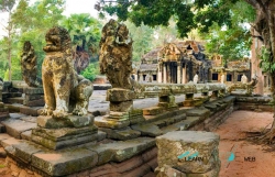
Angkor Wat is the temple most travelers picture when they hear “Angkor,” but it is only one monument within a much larger archaeological landscape. The temple stands in Siem Reap province, Cambodia, and remains an active sacred place as well as a major visitor destination. Understanding that distinction changes how a day here feels: the great towers and galleries are not an isolated backdrop, but part of a Khmer cultural landscape still connected to worship, local communities and ongoing conservation.
The official Khmer-language Angkor Enterprise guide says Angkor Wat was built in the early twelfth century under King Suryavarman II, as a state temple dedicated to Vishnu. It was conceived during the Khmer Empire’s rule, when Angkor was a royal center. The temple later became Buddhist, a transition the same official account places by the late twelfth century. That history is visible not as a simple change from one era to another, but in a monument that has continued to hold religious meaning.