About Lampa, Puno
A highland town known for its pink façades
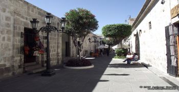
Lampa, capital of its namesake province in Peru’s Puno region, is often called the “Pink City.” Peru’s official tourism portal links the nickname to the pinkish clay used on traditional façades. The town sits around 3,870 metres above sea level, so even a short walk can feel different from a visit at lower elevations. Its historic centre rewards a slow look at adobe houses, tiled roofs, courtyards and stonework rather than a hurried stop for one church photograph. Lampa is also a living provincial capital, with everyday civic and commercial activity surrounding its heritage sites.
Sources describe the town’s beginnings in different ways, and those dates should not be collapsed into one unsupported founding story. PROMPERÚ estimates that the settlement began forming around 1540 amid early Spanish-era mining. A separate Ministry of Foreign Trade and Tourism (MINCETUR) inventory attributes the Spanish foundation of “Santiago de Lampa” to 25 July 1675 and says that date marked the start of construction of the church. The distinction is useful: a place can develop before a formal colonial foundation date. The town later became the provincial capital, and its traditional houses and public buildings remain part of the experience rather than merely a backdrop.
Santiago Apóstol and the La Piedad chapel
The principal landmark is the Church of Santiago Apóstol, also referred to in local tourism material as the Church of the Immaculate Conception. A Puno regional-government study dates its construction to 1675–1685 and describes masonry in light and dark stone, glazed roof tiles and an interior with historic paintings, including a large Last Supper. PROMPERÚ’s visitor profile also highlights the church’s sculpture and paintings associated with the Cusco School. These details help explain why the building is more than a religious stop: it brings together the region’s stonecraft, colonial-era art and continuing devotional life. The church is protected as national cultural heritage.
Inside the church, the La Piedad chapel and ossuary give the visit a more specific focus. The MINCETUR tourism inventory describes the chapel as a semi-restricted area requiring prior coordination with the parish priest or caretaker. Its record lists a visit window of 8 a.m. to noon throughout the year, but permission remains necessary; confirm current arrangements locally rather than assuming the interior is open at those hours. The inventory describes replicas of Michelangelo’s Pietà and an ossuary associated with the former parish cemetery. Because some popular accounts add dramatic details that are difficult to substantiate, this guide sticks to what the tourism record and official visitor pages document.
Historic streets, a damaged bridge and local museums
Beyond the church, the town’s appeal lies in walking its historic core and noticing how the architecture changes from one block to another. MINCETUR describes traditional one- and two-storey adobe houses arranged around patios, with clay-tile roofs and entrances leading from the street through a zaguán. Peru’s tourism portal recommends visiting the casonas, the old houses, and the Kampaq Archaeological Museum; it lists stone objects, ceramics and textiles among the museum’s collections. The sources do not provide dependable current opening hours for the museum, so check with local tourism staff or the municipality before building a tight itinerary around an indoor visit.
One frequently pictured attraction needs an important update: the Republican Bridge of Lampa is not simply an intact colonial bridge to stroll across. MINCETUR’s tourism inventory says the stone-and-sillar structure was built in 1845, rebuilt in 1883 after an earlier collapse, damaged in 2020 and collapsed again on 31 January 2022 after heavy rain and increased river flow. Its latest intervention note, dated July 2023, says topographic work and pre-investment studies for recovery had begun; the inventory still recorded restoration as pending. No later completion notice was found in the official material reviewed for this article. Treat the bridge as a heritage site whose condition must be checked, and obey barriers rather than approaching unstable remains.
Getting there and planning for altitude
Official tourism guidance places Lampa about an hour and a half from Puno by road, while the MINCETUR route inventory for the historic bridge breaks the public-transport journey into two legs: about 45 kilometres and one hour from Puno to Juliaca, then 36 kilometres and roughly 40 minutes from Juliaca to Lampa by minibus. Within town, the inventory puts the minibus stop about 400 metres, or eight minutes on foot, from the Plaza de Armas. These are reference times, not a guaranteed timetable; check current departures and road conditions before leaving. A local taxi or mototaxi may help with the final approach to outlying points.
At this elevation, pace the day and prepare for cold, sun and changing weather. PROMPERÚ lists Lampa at approximately 3,871 metres and gives a general temperature range of 3–14°C, while recommending sunscreen, warm clothing, a windbreaker and sunglasses. Those figures are a planning reference, not a forecast for a particular date. Start with the historic centre, allow time for the church and its permission-based chapel, and add the museum only after confirming its schedule. Lampa’s value is in the combination of highland urban life, stone architecture, devotional art and a complicated heritage record—including places whose present condition differs from old photographs. A little advance checking makes a more rewarding and respectful visit.