About Historic Centre of Arequipa
Historic Centre of Arequipa: a walking guide to Peru’s white-city heritage
Arequipa’s historic centre is best understood on foot, beginning at the Plaza de Armas, where arcades frame the Cathedral and the daily life of the city. The white and pink stone seen across the district is sillar, a volcanic building material that gives Arequipa its familiar “White City” nickname. Yet this is not simply a postcard of colonial façades. UNESCO describes the centre as a meeting of European designs and Indigenous building knowledge, formed in a valley with a much longer human history and repeatedly tested by earthquakes.
The city was founded by the Spanish in 1540 in a valley already intensively farmed by pre-Hispanic communities. The UNESCO property preserves 49 blocks of the original Spanish plan as well as 24 additional blocks dating from the colonial period and the nineteenth century. Its protected area covers 166.52 hectares. These figures help explain why a visit should not be reduced to the square alone: the historic centre is a connected urban landscape of streets, religious complexes, courtyards, bridges and houses, not one isolated monument.
Sillar, earthquakes and a distinct architectural language
Sillar is a light-coloured volcanic stone that can be cut and carved. In Arequipa, builders used it for robust walls, arches, porticoes and vaulted roofs; the material also made detailed façade carving possible. UNESCO notes that the city’s architecture reflects both European and Indigenous techniques, including the work of colonial masters, local masons and Indigenous craftspeople. The result is not a uniform imported style but an urban language shaped by local labour, materials and adaptation.
Earthquakes are part of that story. Seismic events repeatedly damaged buildings and prompted rebuilding, leaving several layers of architectural history visible in the centre. UNESCO identifies successive periods, from the city’s foundation to Baroque expansion, later Rococo and Neoclassical influences, and more recent design. Thick masonry, arches and vaults were practical responses to an unstable setting as well as defining features of the cityscape. When walking the streets, look at how the mass of a wall, a courtyard opening and a carved portal work together rather than treating each façade as a separate photograph.
The plaza and the city’s major landmarks
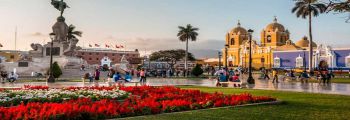
The Plaza de Armas is the historic core. Its arcades, municipal buildings and Cathedral form a compact introduction to the city’s civic and religious life. At one corner, the Church and cloisters of La Compañía preserve a particularly notable example of the “mestizo Baroque” associated with the late eighteenth century. The Cathedral visible from the square dates to the nineteenth century in its present form. Together, the plaza and its edges show how Arequipa’s public space joins religious institutions, government and everyday commerce.
Beyond the square, the Monastery of Santa Catalina is a large religious complex whose buildings represent styles from the sixteenth to the nineteenth centuries. The San Francisco complex combines a small square, church, convent and cloisters, while churches and convents associated with Santo Domingo and other orders add further layers to the walk. These sites have their own custodians, entry arrangements and opening times; they should not be assumed to share one schedule simply because they lie inside the same UNESCO district.
Historic houses, or casonas, are another essential part of the experience. UNESCO records roughly 500 in the centre, many organized around inner courtyards reached through large doorways and passageways. Some have been restored and adapted for cultural or administrative use rather than remaining private residences. A visitor may therefore encounter a museum, cultural venue or public institution in a building whose original layout still reveals the domestic architecture of the city. Check each venue’s current admission rules before planning an interior visit.
How to plan a visit
Start at the Plaza de Armas and allow time to look along the arcades, then explore adjoining streets at a slower pace. The square is an open public space; churches, museums and restored houses around it are separate attractions and may charge admission or limit access. The UNESCO listing is an urban property, not a single ticketed site, so there is no single visitor timetable for the whole historic centre. Confirm current schedules directly with each institution, especially on religious holidays or during restoration work.
Comfortable walking shoes are useful on stone-paved streets, and the sunny, high-altitude setting makes water and sun protection sensible. Keep an eye on traffic when crossing busy streets, and respect signs marking private courtyards or active religious spaces. If you have only a short stay, prioritize the plaza and one or two interiors rather than racing between every landmark. With more time, follow the changing façades and courtyards toward San Lázaro, where the surviving layout of an Indigenous settlement near the centre offers a reminder that Arequipa’s story did not begin with the Spanish foundation.
UNESCO inscribed the Historic Centre of the City of Arequipa in 2000 and identifies the municipality as manager of its public spaces, working with national heritage authorities. For background on the boundaries, architecture and heritage values, consult the UNESCO World Heritage entry. The district’s appeal lies in the relationship between stone and city life: the plaza is a useful starting point, but the courtyards, churches, streets and volcano-framed setting explain why Arequipa is more than a collection of photogenic white buildings.