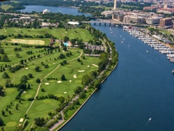
Washington, DC is often introduced through its government buildings, but the capital’s story begins before the federal city was planned. The National Park Service describes the Nacotchtank people as among the Indigenous communities who lived, farmed, fished and traded along the Anacostia and Potomac rivers. The river junction offered food, transport and connections between communities. European colonization brought displacement, conflict and disease; the name Anacostia itself preserves a linguistic trace of the Nacotchtank name. Reading that history first changes the way the capital’s monumental landscape appears.
Congress passed the Residence Act in 1790, authorizing a permanent federal district on the Potomac. George Washington selected the site around the rivers’ confluence, and French-born planner Pierre Charles L’Enfant laid out a city of broad avenues, public squares and diagonals that linked prominent sites. The federal government moved from Philadelphia in 1800, when the new city was still unfinished. The planned geometry remains visible from the National Mall, where long sightlines connect the Capitol, Washington Monument and Lincoln Memorial.