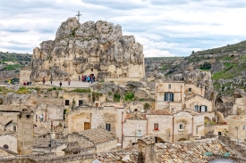
Across the ravine from Matera’s Sassi, the Murgia plateau preserves a cultural landscape of caves, rock-cut churches, prehistoric settlement and pastoral architecture. The official name—Parco Archeologico Storico Naturale delle Chiese Rupestri del Materano—captures its unusual range. This is simultaneously an archaeological park, a protected natural environment and a record of religious communities that carved chapels into limestone slopes.
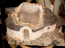
Human activity reaches back to the Neolithic, visible at the ditched village of Murgia Timone. Later inhabitants cut cisterns, dwellings, livestock shelters and places of worship into the rock. Medieval churches preserve architectural details and, in some cases, fragile wall paintings shaped by Latin and Byzantine religious traditions. They were created across different centuries and contexts; calling every cave a hermitage or assigning all frescoes to “Byzantine monks” oversimplifies a complex landscape.