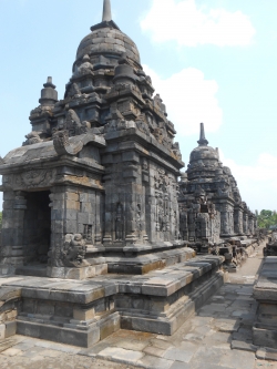
Borobudur rises above the Kedu Valley of Central Java, in Magelang Regency, as a monumental Buddhist complex rather than an isolated pile of carved stone. UNESCO describes the property as three connected monuments: Borobudur itself and the smaller Mendut and Pawon temples, aligned east of the main sanctuary. That relationship matters to visitors: the famous pyramid is the centrepiece, but its historical setting extends across a wider landscape shaped by worship, movement and settlement.
The main temple was built during the eighth and ninth centuries under the Sailendra dynasty. Its builders worked with a volcanic hill and transformed it into a stepped structure that could be approached from the surrounding plain. The monument later ceased to function as a Buddhist sanctuary sometime between the tenth and fifteenth centuries, according to UNESCO. That long interval is part of its story; the site was not simply a continuously active temple with an unchanging role.